
Whipple Section
- Overview
- Akron
- Bedford
- Belle Valley
- Bowerston
- Burton
- Caesar Creek
- Defiance
- Delphos
- Loveland
- Massillon
- Medina
- Mogadore
- New Straitsville
- Norwalk
- Old Man's Cave
- Pemberville
- Road Fork
- St. Marys
- Scioto Trail
- Shawnee
- Sinking Spring
- Stockport
- Troy
- West Union
- Whipple
- Williamsburg

Trail Description
Bean Ridge
MD Edmonds
Supervisor: MD Edmonds
• 740-885-9644
58.2 Total Miles / 14.1 Off Road Miles (24.2%)
Map Publication Date: December 2020
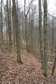
The Whipple Section is one of the less populated sections of the Buckeye Trail. There are no resupply facilities along the trail. Those nearest to the trail are located in Caldwell and Marietta. The extraction industries dominate industrial activity. The section lies entirely within the unglaciated, highly dissected Appalachian Plateau. Whipple Section begins on a dirt road on a lonesome, wooded ridge in Washington County at an elevation of 1081 ft and undulates about 10,000 ft as it descends to its destination at an elevation of 682 ft on a dirt road in the lonesome, wooded valley of Onion Run. Along the way, the trail either visits or skirts the sleepy communities of Caywood, Crooked Tree, Hackney, Macksburg, Warner and Whipple in the Duck Creek Valley. You can grab a hamburger at either of 2 restaurants, a bar on the trail in Whipple and a small restaurant just off the trail near the I 77 exit at Macksburg.
Trail Alerts
- (10/8/19)Side Trail Closure
Between Pt 6 and 7, the side trail to the campsites at the Lane Farm Campsite off SR 26 has been effectively closed by perennial problems with washouts created by the Little Muskingum R at the Campsite itself. The campsites may still be reached from Pt 7 as the following: BT joins SR 26 heading SW. After 0.24 mi, where the BT exits SR 26 NW onto Eightmile Rd (T31), continue generally SW on SR 26 as it meanders another 1.5 mi to the Lane Farm Campsite. The $10 fee is payable in a slotted iron pipe located near the registration kiosk.
Map Updates
- (10/23/2020) Halfhill Campsite
This trail change is released because the Halfhill Campsite is now open for use by backpackers on the Whipple Section of the trail. In addition, we added the opportunities already published in the most recently published Whipple Section (October 2010) in the format used during the last several years.
CAMPING ALONG THE TRAIL
The location of all camping facilities within the Whipple Section that are both known to BTA and within reasonable walking distance of the trail are shown on the map and listed below. Rules are established by the landowners in all cases.
- 1. Between Pt 1 and 8, dispersed camping is permitted within the Wayne National Forest. The rules: use minimum impact methods, camp out of sight from the trail and, most important, be sure that you are on property that is owned by the USDA Forest Service and not designated as a park site. Segments of the Forest that meet these criteria may be found scattered along the trail between Pt 1 and 8.
- 2. Between Pt 7 and 8, find the Lane Farm campsites. Facilities: P, Pr, PT. From Pt 7, follow SR 26 W towards Marietta for 1.7 mi.
- 3. Between Pt 12 and 13, find the Halfhill Campsite. This is a primitive campsite with no facilities although water (purification necessary) can usually be found in a stream within 100' of the site. The site is some distance from the trail. However, the route from Pt 12 to the site and back to the trail at Pt 13 is both quite scenic and 0.3 mi shorter than the main route. See the Halfhill Campsite Log elsewhere. If you plan to use this campsite, we recommend that you follow the log which is an alternative route to the BT itself.
The Buckeye Trail Assn does not manage any campsites within this section. Dispersed camping is not permitted on private or state lands without express permission of the owner/manager. Hikers are expected to comply with all rules in all instances.
Request special camping information from the BTA at
THE HALFHILL CAMPSITE LOGCW CCW Pt 0.0
N2.8
S12 Reeds Run Rd (T331) at Berg Church Rd (T332)
From the S end of this extended, triangular intersection (a road sign on its highest corner), exit Reed's Run Rd. Bear N onto Berg Church Rd. After 0.9 mi, BT turns W onto Nichols Rd (T329). To get to Halfhill Campsite, continue N on Berg Church Rd past a surprisingly large cemetery and the still active church (400’). Berg Church Rd ends after 100’. Turn E onto Nichols Rd (T329), which reappears as a poorly maintained track, and descend. After 0.3 mi, Nichols Rd ends at Whipple Run Rd (T24). Follow Whipple Run Rd generally N as it meanders across Whipple Run (500') and passes Offenberger Rd (T518, 250', exits E).1.1
ESE1.8
SA Whipple Run Rd (T24) at Trail to Halfhill Campsite
Location: 39.50815N, 81.39542W. From here, a trail leaves the road ESE. The trail meanders over and around a very low ridge. After 0.16 mi, reach the Halfhill Campsite, located at 39.50866N, 81.39324W. Use of this primitive campsite is free for backpackers. Follow minimum impact methods. Purify water from the stream downhill just 100' away. Notify the Owner at when you will be at the site.
To return to the trail at the next point, head N on Whipple Run Rd. After 400', pass a side-road, T517, that exits WNW. Continue past Becker Rd (T38, 0.24 mi, exits N) as Whipple Run Rd turns N. After 0.14 mi, pass T517 that returns from the S. After 0.5 mi, cross Whipple Run and, soon, pass Whitely Rd (T522, 400', exits SW). After 0.6 mi, rejoin the BT on Kohl Rd (T391). Turn N across Whipple Run and enter Whipple.2.8
S0.0
E13 Kohl Rd (T24) at SR821 in Whipple
This is the end of the Halfhill Campsite Log. - (1/2/20) Road Name Correction
Recently, we learned about an error that you may see in your Whipple Section Map, Edition of October 2010. If you are lucky enough to have bought your map with the 60th Anniversary logo on the back cover page and/or see the date 1/2019 or later beneath the QR code in the lower right hand corner of the back cover page, the correction has already been made.
To make the correction, Under Point 3 in the second paragraph, line 6, change the road name “Chandler” to “Felter”. That’s all, folks. - (10/19/19) Facility Update
Section Supervisor Matthew Edmonds has announced that Near Pt 13, the small G at 90 Railroad St in Whipple has closed. In addition, the overnight camping near that store is no longer available.
- (12/23/10) Update for Whipple Map Edition of January 2005
This update is intended to keep the former edition current for the benefit of those who purchased the former edition recently. The major changes are a relocation and significant editing of the text prior to Pt. 6 (number applies to either edition). The relocation leaves the former route at the intersection of Cow Run Rd and Laurel Hill Rd between Pt. 6 and Pt. 7 (either edition). It returns to the former route at the intersection of Pleasant Ridge Rd and Morris Rd between Pt 10 and Pt 11 (former edition only). The text for the Alert begins at Pt. 1 and ends at former Pt. 12 (current Pt. 11), "Caywood Rd (C16) at Stanleyville Drive (C42)".
The text for the Alert is extracted directly from the October 2010 Edition. The distance adjustment is negligible: -0.1 mile on Pt. 12 and higher in the older edition. For the record, the locations of Pt. 1 through Pt. 5 match exactly in both editions. On the former edition, Pt. 6 was drawn incorrectly at the intersection of Brooks and Cow Run Roads. Move the location of Pt. 6 about 1/2 mile NE on your map.
| CW | CCW | Pt | |
|---|---|---|---|
| 0.0 S |
57.6 N |
1 | BT at County Road Nine (C9) The WHIPPLE SECTION of BT begins here. The trail immediately CCW (N) is described in the ROAD FORK SECTION. This site is also the northern trailhead for the Scenic River Trail. BT heads SW essentially parallel to County Road Nine. In 500', BT turns generally S along ridge for 2500' before dropping into an intercepting reentrant that joins valley of an intermittent tributary to Reas Run. In 3200', BT crosses stream and meanders up another ridge, sometimes steeply, first W, then S and finally NW to summit the ridge (2100'). BT follows ridge S 1300' before beginning descent, more or less steeply, to a second tributary to Reas Run (4200'). BT meanders generally NW up first a reentrant and later a hogback onto Bell Ridge. |
| 2.9 W |
54.7 E |
2 | County Road Nine (C9) NE of Deucher BT continues on gated skid road now W and circles former community of Deucher. Trail crosses several skid roads. In 2600', BT crosses paved Archer's Fork Rd (C14) and meanders generally W along Pine Ridge just N of Independence Chapel and Cemetery. In 2800', BT joins County Road Nine and continues W along Pine Ridge. In 3700' with a slight climb in view, BT leaves County Road Nine onto footpath heading NW. In 1000', footpath joins a skid road that meanders generally N. In 2600', BT comes to a fork in the skid road and turns W. In 200', BT turns N onto footpath that meanders along ridge before it descends, sometimes steeply with switchbacks, into valley of intermittent tributary to the Archer's Fork. |
| 6.1 W |
51.3 E |
A | BT at Big Run Rd (T414) Big Run Rd is unmarked. It looks more like a driveway than a road. Big Run Rd exits S from Archer's Fork Rd 2.7 miles E of SR 26. The trail intersection is 650' S of Archer's Fork Rd. Several cars can park off the road with care. BT ascends W to ridgeline at average 11% grade (3100') and then descends to a fork of Oxbow Run at an average grade of 18% (1500'). BT continues W across two intermittent tributaries to Oxbow Run. At a third stream, also tributary to Oxbow Run, BT ascends steeply to Chandler Rd (T381) in 2100' (13%). BT heads W out ridge for 600' and then descends S through two deep reentrants to tributary of Bear Run (3100'). BT crisscrosses stream W before climbing a tad S to avoid houses. |
| 8.9 W |
47.7 E |
4 | BT at Bear Run Rd (C25) BT ascends valley slowly. About 350' after crossing an intermittent stream, BT climbs 16% grade to a promontory off Bean Ridge (1200') and continues W across Brooks Rd (T94, 3500'). BT undulates generally WNW for 1900' through woods. |
| 10.2 W |
47.4 E |
5 | Brooks Rd (T94) and McCain Hill Rd (T382) BT heads W on Brooks Rd. In 190', BT joins footpath that exits NW and undulates generally W on Bean Ridge parallel to Brooks Rd. In 6200' on a promontory that juts from Bean Ridge to NE, BT descends NW. In 2000' after a knee-busting drop (20 %!), BT reaches the flood plain of the Little Muskingum R and meanders generally W along river. In 6000', BT reaches a switchback at an intermittent stream in a deep reentrant. From here, BT meanders and undulates generally SE through several ascent/descents with a maximum elevation change about 200' (28%). |
| 14.3 S |
43.3 NE |
6 | BT at Brooks Rd (T94) BT joins Brooks Rd near a ravine filled with junk. Heading generally S, Brooks Rd descends into valley of Cow Run. In 2700', at end of Brooks Rd, BT joins Cow Run Rd (T19) and heads W through farms past Star Rd (T1445, exits N), past Laurel Hill Rd (3300', T302, exits S) and across the Little Muskingum R (180'). |
| 15.5 W |
42.1 E |
7 | Cow Run Rd (T19) at SR 26 Note interesting cemeteries on NE corner as well as on N side of SR 26. BT joins SR 26 heading SW. In 1250', BT leaves SR 26 and heads NW onto Little Eightmile Rd (T131). As Little Eightmile Rd turns more N (339'), BT continues NW now on Tittle Run Rd (T43) that climbs through an interesting reentrant. |
| 17.2 E |
40.4 SE |
8 | Tittle Run Rd (T43) at Pleasant Ridge Rd (C17) In 7500', BT emerges at the end of Tittle Run Rd onto Pleasant Ridge Rd (C17) that heads W past Morris Rd (6100', T334, exits S) |
| 19.2 W |
48.4 E |
9 | Pleasant Ridge Rd (C17) at Grub Rd (T335) In 4200', BT turns sharply N onto Grub Rd and descends into valley of Duck Creek. |
| 20.3 W |
37.3 E |
10 | Grub Rd (T335) at Caywood Rd (C16) BT turns NE on Caywood Rd. In 2500', BT crosses Killwell Run. BT continues NE on Caywood Rd past Killwell Run Rd (300', T331, exits E). In 6200', BT crosses Sugar Run and continues on Caywood Rd now NW past Sugar Run Rd (290', T37, exits E) and Collins Rd (500', T491, exits N). BT continues on Caywood Rd, now W, across Hoff Run (2900') near outskirts of Stanleyville. |
| 23.0 N |
34.6 E |
11 | Caywood Rd (C16) at Stanleyville Rd (C42) BT turns N on Stanleyville, etc. |
Trail Towns
- There are no Trailtowns in this Section at the present time.
Section Blogs
- (4/9/25) Whipple Section Blog - Intro to the Wilderness Loop. The Buckeye Trail Wilderness Loop is a unique and captivating specialty loop, but emergency preparedness is essential in Whipple and Road Fork. What makes the Wilderness Loop different? What kind of vehicle do you need? Where can I find parking? What do I need to keep in my car for emergency supplies? What do I need to know about driving on one-lane roads in the wilderness? Read on to find answers to these questions. Victoria Livingston has the answers from first-hand experience in her newest blog post at Buckeye Trail Wildernees Loop Part 1 and Emergency Preparedness
- (4/9/25)Whipple #1-7 has rugged terrain, steep hills, and obstacles. Have you heard of Escape the Room? This is the forest version: A group of hikers work together to conquer challenges, searching for blue blazes and finding their way around obstacles. Although challenging, the forest holds treasures like the idyllic Little Muskingum River, Bear Run, and rocky outcrops. The NCT shares the route with the Buckeye Trail. You can read Victoria Livingston's blog post Here
- This is a link to the Whipple Section Supervisor's blog.