


- Home
- REPORT TRAIL PROBLEM
- BT Overview Map
- BT Trail Towns
- How to Hike the Trail
- Events
- Social Media
- Maps & Guides
- Trail Alerts/Map Updates
- Contact Us

Buckeye Trail Maps & Guides
The Buckeye Trail Association offers both electronic and printed maps & guides.

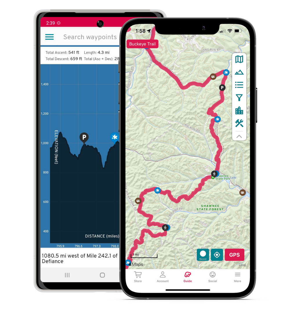
FAROUT
The Buckeye Trail FarOut App:
- Most popular smartphone app for long distance hikers
- Pinpoints your location on the trail
- Contains maps, elevation profile and points of interest
- List of campsites, trailheads, parking lots, water sources, restrooms and section points
- You choose the base map type: topo, satellite, terrain or Google map.
- Automatically calculates mileage to all points on the trail
- Clockwise or counter-clockwise trail navigation
- Works completely offline with your device's internal GPS
FAROUT THRU HIKER SPECIAL: Entire trail for $39.99 or available in sections from $4.99 to $14.99.


LEARN MORE: https://going-farout.co/buckeye-trail
![]()
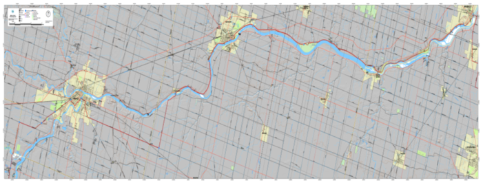
AVENZA MAPS
The Buckeye Trail Avenza Maps:
- Geospatial PDF files
- Pinpoints your location on the trail
- List of campsites, trailheads, parking lots, water sources, restrooms and section points
- Contains section point descriptions
- Works completely offline with your device's internal GPS
- Available for all 26 Buckeye Trail sections
- Hiker On The Go maps available too
AVENZA BUCKEYE TRAIL BUNDLE: Entire trail for $119.99 or sections for $6.99/each. Cost saving bundles available.
LEARN MORE: https://www.avenzamaps.com/vendor/3587/buckeye-trail-association

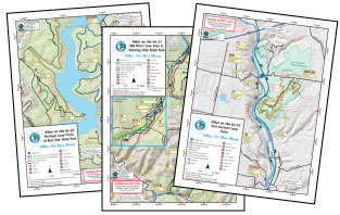
PRINTED SECTION MAPS
Hiker-certified! They’re declared as essential by circuit hikers and thru-hikers all! BTA maps contain a graphic map plus a narrative log.
About the map portion:
- Campsites, trailheads and other landmarks clearly noted
- On- and off-road portions differentiated
- Mileage noted from either beginning or end of the section
About the narrative log portion:
- Historic information
- Detailed info to clarify confusing intersections or other portions
- Entertaining!
- Fables recounted
- Local lore revealed
- Geological, biological, topographical—and all kinds of other—information imparted
Maps are waterproof, 11" x 17", folded to 3-3/8" x 5-1/2"
26 map sections about 50 miles each
PURCHASE MAPS HERE: https://shop.buckeyetrail.org/bt_trailshop/shop/page/maps
PRINTED HIKER ON THE GO MAPS
The Hiker on the GO series is new series of maps covering interesting loop and side trail along the Buckeye Trail! The maps provide information on the hike and an overview of the area along with locations of the nearest amenities and GPS coordinates of the parking areas and special sites along the trail.
Maps are waterproof, 8-1/2" x 11", folded to 8.5" x 3.66"
PURCHASE HIKER ON THE GO MAPS HERE: https://shop.buckeyetrail.org/bt_trailshop/shop/product-detail/1000421