
Defiance Section
- Overview
- Akron
- Bedford
- Belle Valley
- Bowerston
- Burton
- Caesar Creek
- Defiance
- Delphos
- Loveland
- Massillon
- Medina
- Mogadore
- New Straitsville
- Norwalk
- Old Man's Cave
- Pemberville
- Road Fork
- St. Marys
- Scioto Trail
- Shawnee
- Sinking Spring
- Stockport
- Troy
- West Union
- Whipple
- Williamsburg

Trail Description
Miami and Erie Canal near Napoleon.
Andrew Bashaw
Supervisor: John Nemcik
• 419-957-8817
54.8 Total Miles / 38.5 Off Road Miles (70.3%)
Map Publication Date: July 2017
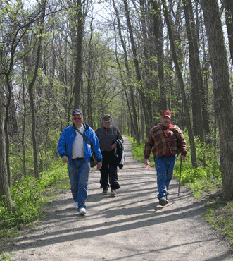
The southern half of this section is all on-road. It follows county roads with light traffic. The trail then enters the city of Defiance where it follows sidewalk along tree-lined streets, crosses the Maumee River, and turns east through Pontiac Park, where there is a monument to Johnny Appleseed. The trail continues on-road to and through Independence Dam State Park, past the old canal locks. It follows along the Miami and Erie Canal on the towpath most of the way through Napoleon and on past Providence to Waterville.


Trail Alerts
- (03/1/2024)This alert applies to a section of the trail to the east of Point 15. Tree clearing along the Buckeye Trial at the Miami and Erie Towpath Canal Wetlands project will be completed on Tuesday March 12th. Tree clearing will take place at the at the two inlet locations and construction entrance. Tree felling activities should only take one day, the trail will be temporarily closed during the day while work is taking place.
Map Updates
- (12/11/2023) This information updates the Defiance map dated July 2017 and refers to the Camping Along the Trail section of the map. The third listing concerning camping at Camp Widewater is no longer valid. The camp has been sold and is not available to BTA members. Please ignore the information about Camp Widewater in the update below dated 03/1/2023.
- (03/1/2023) This information also updates the Defiance map dated July 2017 and refers to the Camping Along the Trail section of the map. There are several changes:
- The entirity of the second listing (2) is invalid. Susie Q's Canoe Livery and camp is no longer in business.
Replace this listing for a new one that states - At 1.7 miles E of Route 6 overpass, a primitive campsite is available at the Black Swamp Conservancy (insert lat/longs) Call the Director (419) 833-1025 at least 48 hours prior. - In the third listing (3), the phone number for contacting Camp Widewater is now 380-223-2267.
- The entirity of the second listing (2) is invalid. Susie Q's Canoe Livery and camp is no longer in business.
- (02/21/2023) This information updates the Defiance map dated July 2017. Defiance Section Supervisor John Nemcik, provided the information for the update due to a new, paved bikepath available near end of the Point 11. Please change the last three sentences of Point 11 to read: After 1.0 mi, exit Ritter Park onto paved bike path and continue E into Napoleon. After 0.45 mi, jog S onto Front St. Continue E on Front St.
- (02/21/2023) This update is for the Buckeye Trail Data Book, First Addition, 2019. On page 133, the Defiance Section, the 9th entry: Change entry starting with "Turn left onto towpath"... to read " Turn left onto towpath NE (50 feet past mailbox 20495)."
- (06/08/2022) The North Country Trail (NCT) has made a change to their trail that followed the BT to BT Point 14. The NCT will now continue on the BT to Point 20 and exit there to continue their trail going north. This requires an update to the BT's Point 14 and 20 in the Defiance Section. See the updated Point descriptions below:
CW CCW Pt Description 35.3
E18.6
W14 Intersection of C424 and SR 109 (R)
To the W of this point, C424 is generally known as E Riverview Drive; to the E, as Old US 24. Continue E past a roadhouse. Cross SR 109 (exits S). Enter North Turkeyfoot Wildlife Area. After 0.7 mi, reach a parking area for hikers [41.41245° N, 83.99671° W]. Facilities: P, PT. Contine E 0.3 mi and cross Turkeyfoot Creek on footbridge. Proceed N on dirt path 300' to hunter parking area (Bulletin Board, P, PT) [41.41478° N, 83.98940° W]. Exit E onto grassy path that turns S. After 150', turn E through old shed. After 0.26 mi at trail intersection, jog N onto gravel drive. After 500', join Old US 24 heading E. After 200', Old US 24 crosses Dry Creek on a stone culvert built for the canal. If interested, a view is found with a little bushwhacking S of the road. After another 500', join Towpath Trail above Dry Creek. After 0.4 mi, cross ODNR drive [41.41905° N, 83.97414° W] to river access w/P. After 0.35 mi, towpath disappears, probably because of erosion caused by Maumee R. Drop onto grassy flat along river and continue E. After 0.45 mi, trail returns to narrow towpath above river with one temporary departure onto lawn. After 0.6 mi at grassy area, further progress on towpath trail is blocked by structure. Jog N. At Old US 24 [41.42352° N, 83.95022° W], turn E along berm of road.
52.7
E1.2
W20 Bike Path at S River Rd (C53)
Note: this description was updated on 2-7-2023 for clarification. NCT exits here. BT hikers continue on the BT as described in the map update identified below on 11-5-2020.
In addition, the box titled "North Country Scenic Trail" on page 2 of the Defiance map, also changes to:
Extending from Crown Point State Park in eastern New York through 7 states to Lake Sakakawea on the Missouri R in central North Dakota, NCT is approximately 4600 miles long. Legislation is pending to extend the trail into Vermont to connect with the Appalachian Trail. NCT makes a 1067 mi swing through Ohio. Both BT and NCT follow the same route for 52 miles through the Defiance Section between Junction (Point 1) and the end of the Towpath Trail at River Rd (Point 20) where the NCT goes north. BTA maintains much of the NCT within Ohio. For more information about NCT, visit https:/northcountrytrail.org. - (06/02/2022) This map update corrects the map update of 5-26-2022. It moves the trail off-raod for a short section and as a result changes the location of Point 5 to 0.10 mi south of its former location. This mileage change is incorporated into the point description for Points 4, 5, and 6 below in the Log of Trail Change.
Log of Trail ChangeCW CCW Pt Description 6.7
NE48.1
SW4 Canal Rd 156 at Kiser Rd 30 and Kibble Rd 155
The height of land just ahead contains the Defiance Reservoir. From the NE corner of this intersection, follow the bike path NE. After 0.1 mi, reach a 3-way intersection of paved trails. Turn back W on trail that curves slowly to the N beneath the reservoir. After 0.45 mi, pass the Defiance Reservoir Park Campsite on the W side of Kibble Rd. Facilities: C, Cast Iron Grills, P, PS, PT. Location: 41.26768°N, 84.39984°W. Continue N on paved trail across driveway (300ft) that leads to a handicapped parking on the rim of the reservoir. Go N past parking lot and enter woods and brushy areas. Within this area, the trail turns E and joins a boardwalk. After 0.5 mi, exit the boardwalk onto paved trail that turns SSE parallel to Precision Way and passes a parking lot (0.11 mi). After 0.22 mi, reach a 3-way trail intersection. Turn E across Canal Rd a short distance to the end of the bike path at driveway that uses part of the former Canal Rd (200ft). Turn N. After 70ft, turn NE onto S Jackson St. After 0.45 mi, pass Legion Field, a city ball field (P). Hudson's Lock 34 is located near the S corner of this park. Continue NE on S Jackson St 0.10 mi to Dotterer St. Turn SE onto Dotterer St and continue 0.10 mi to Clinton St. Cross S Clinton St and turn NE on the sidewalk. After 0.32 mi reach Sunday St and in another 300 ft, reach the intersection of Clinton St with Deatrick St to the NW and Downs St to the SE.
9.2
SE45.6
NW5. S Clinton St at Deatrick and Downs Sts
Continue SE on Downs St. At the end of Downs St (0.4 mi), turn NE onto Jefferson Ave (SR 66), a beautiful tree-lined street. After 0.34 mi at Williams St, jog 1 block SE to Washington Ave. Follow Washington Ave NE past several churches and the site of Fort Winchester. Bounded by Third St, Jefferson Ave, First St and Washington Ave, the fort was in service during War of 1812. Washington Ave ends at Fort St. Continue NE on lawn into Old Fort Defiance Park.10.4
NW43.2
SW6. Point of Land at Confluence of Auglaize and Maumee Rivers
Note: In the CW direction, increase the mileage at each point by the 0.10 mi from Points 7 to 21. In the CCW direction, decrease the mileage at each point by the 0.10 mi from Points 3 back to 1. - (05/26/2022) This Trail Change provides access to an interesting trail in the wet woods in Defiance Reservoir Park. The change is located between Pt 4 and 5 near or within the SW corner of the City of Defiance. Backpackers should find the change pleasing since the trail now passes almost through the Defiance Reservoir Park campsite. The description of the trail below applies directly to the Defiance Map Edition of July 2017. The change added a net of 0.7 miles of trail off road to the Defiance Section. The new length of the Defiance Section is 54.7 miles. The relative length of trail off road is 70.4%.
CW CCW Pt Description 6.7
NE48.0
SW4. Canal Rd 156 at Kiser Rd 30 and Kibble Rd 155
The height of land just ahead contains the Defiance Reservoir. From the NE corner of this intersection, follow the bike path NE. After 0.1 mi, reach a 3-way intersection of paved trails. Turn back W on trail that curves slowly to the N beneath the reservoir. After 0.45 mi, pass the Defiance Reservoir Park Campsite on the W side of Kibble Rd. Facilities: C, Cast Iron Grills, P, PS, PT. Location: 41.26768°N, 84.39984°W. Continue N on paved trail across driveway (300ft) that leads to a handicapped parking on the rim of the reservoir. Go N past parking lot and enter woods and brushy areas. Within this area, the trail turns E and joins a boardwalk. After 0.5 mi, exit the boardwalk onto paved trail that turns SSE parallel to Precision Way and passes a parking lot (0.11 mi). After 0.22 mi, reach a 3-way trail intersection. Turn E across Canal Rd a short distance to the end of the bike path at driveway that uses part of the former Canal Rd (200ft). Turn N. After 70ft, turn NE onto S Jackson St. After 0.45 mi, pass Legion Field, a city ball field (P). Hudson's Lock 34 is located near the S corner of this park. Continue NE on S Jackson St past Linden St (0.1 mi).9.1
N45.6
S5. S Jackson St at Deatrick St (G) - (03/30/2021)
This trail change at Defiance Reservoir Park is added to the much shorter change completed at the north end of this section [11/05/20]. Because the trail was moved between Pt 19 and Pt 21 and Pt 21 was moved from its location as shown originally on the Edition of July 2017, the titles and updated distances for those points are shown below. In between these ranges, that is for Pt 6 to 18, add 0.7 mi to all CW distances and 0.1 mi to all CCW distances. There is one more change. Please add 0.8 mi to all CCW distances below Pt 4.
CW CCW Pt Description 51.8 2.9 19. Farnsworth Metropark 53.1 1.6 20. Bike Path at S River Rd (C53) 54.7 0.0 21. S River Rd at Mechanic St (SR 64) in Waterville
- (11/5/2020) This information updates the Defiance Map, Edition of July 2017. It is needed because the location at which the BT leaves Farnsworth Metropark has been moved. Formerly, the trail left Farnsworth Metropark E of Roche de Bout Shelterhouse onto S River Rd at the Bridge Overlook site. Now, the trail leaves Farnsworth Metropark on a bike path just W of Roche de Bout Shelterhouse. Since Pt 20 on the previous Defiance Map had been associated with the former site, we have moved Pt 20 to the new exit from the metropark, a step which both shortened the distance between Pt 19 ((Farnsworth Metropark) and new Pt 20 and lengthened the distance between new Pt 20 and Pt 21 (S River Rd at Mechanic St (SR 64) in Waterville). Overall, the updated distance (54.0 mi) within the Defiance Section is now slightly greater than the original distance (53.9 mi). The details related to Pt 19 through 21 are given below.
CW CCW Pt Description 51.1
NE2.9
SW19. Farnsworth Metropark
Continue NE through the highly developed Farnsworth Metropark, a unit of Metroparks Toledo (C, P, PS, PT, W, WC). The large island seen in the river is named Parker Island by the Waterville Historical Society. It is more commonly named Missionary Island and is owned by Ohio Division of Wildlife. Prehistoric Native American sites may be present. After 1.3 mi near the N end of Missionary Island, exit the Towpath Trail onto a bike path; turn NW.52.4
N1.6
S20. Bike Path at S River Rd (C53)
Cross S River Rd and then Waterville Monclova Rd (150'). Continue on the bike path parallel with S River Rd. After 0.28 mi, continue on the bike path that now parallels the Anthony Wayne Trail as S River Rd exits the highway E. If you look S, you can see a sign along the Towpath Trail in Farnsworth Metropark that tells about the Bowling Green fault, the only known fault line near the Great Lakes. The fault extends about 100 mi from Findlay, Ohio, into Michigan. It crosses the park here. When the water level in the Maumee R is very low, the fault is exposed in the river bed. After 1.0 mi on the S side of Farnsworth Rd, exit the bike path; cross Anthony Wayne Trail and continue E along the sidewalk on the S side of Farnsworth Rd. After 3 blocks, turn N onto the sidewalk along the E side of S River Rd.54.0
E0.0
S21. S River Rd at Mechanic St (SR 64) in Waterville
The DEFIANCE SECTION ends here. The PEMBERVILLE SECTION describes the next Section CW (E).
This map update ends here.
- (7/12/17) Independence Dam State Park is now offering 25 walk-in, non-electric campsites and non-potable water. They are available on a first come, first serve basis. Register upon arrival at the kiosk at the entrance to the campground. The park's web site is http://parks.ohiodnr.gov/independencedam
- (7/7/17)A new Defiance map is now available with the publish date of July 2017.
Trail Towns
Defiance - Trail Town Dedication June 23, 2018
Defiance is the heart of the historic Maumee River Valley and is where the Maumee and Auglaize Rivers meet. From its earliest days, Defiance has been a hub for the shipping and receiving of goods. Whether it was early supplies passing through Fort Winchester or goods being transferred on the Miami-Wabash and Erie canals that ran through the community, transportation has played a major role in our development. In later years the addition of several railways that traveled through Defiance helped to facilitate the industrial growth that continues to support the city today.
Explore the history of the area by visiting the site of the old French Apple Tree in Pontiac Park where tribute is paid to Johnny Appleseed’s influence. In Canal Park, catch a glimpse of days gone by at the restored Miami and Eric Canal Lock. Spend a day in the surrounding vicinity experiencing the small town feel of the country farms and abundant farmland, continue your experience at one of the inviting shopping centers or beautiful parks. Don’t leave town without spending time in the revitalized Main Street District of Downtown.
Napoleon, Trail Town Dedication May 16, 2019

Napoleon is excited to welcome you as you explore the Buckeye Trail in Northwest Ohio! Napoleon is a community of just over 9000 people located on the Maumee River just a half hour southwest of Toledo. As you trek through our area, it’s easy to transport yourself back hundreds of years and revisit the footsteps of Native Americans who called this land home. A large portion of the Buckeye Trail through Napoleon is part of the original Tow Path for the Miami Erie Canal – the water highway that led to the growth of our region.

If you are looking to make a day (or longer) stay in Napoleon – make sure you take a moment to explore the community. There are a multitude of events going on in this vibrant community – find out what’s happening (and where) on the web at henrycountychamber.org or contact the Henry County Visitors Bureau at (419) 592-1786. They’d be more than happy to help you craft your stop and point out the fun you’d like to dive into.
Napoleon will open its doors and its arms to you whenever you plan on stopping through! We’re proud to embrace the history of the area and welcome you to become part of our present and future!
Section Blogs
- There are no Blog posts at the present time.