
Caesar Creek Section
- Overview
- Akron
- Bedford
- Belle Valley
- Bowerston
- Burton
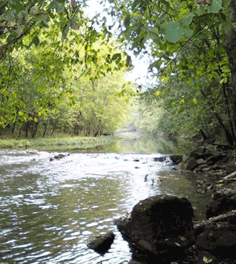
- Caesar Creek
- Defiance
- Delphos
- Loveland
- Massillon
- Medina
- Mogadore
- New Straitsville
- Norwalk
- Old Man's Cave
- Pemberville
- Road Fork
- St. Marys
- Scioto Trail
- Shawnee
- Sinking Spring
- Stockport
- Troy
- West Union
- Whipple
- Williamsburg

Trail Description
Caesar Creek.
Preston Bartlett
Supervisor: Vicki Proctor
•
55.1 Total Miles / 42.9 Off Road Miles (77.9%)
Map Publication Date: November 2013
The Buckeye Trail enters this section on the Little Miami Scenic State Park bike trail, but leaves it immediately to follow country roads into Caesar Creek State Park. Here you enjoy over 20 miles of off-road, unpaved hiking along the lakeshore, passing the public beach. North of the park, the trail follows a combination of back roads and rail-trail through the college town of Yellow Springs. The BT continues soutwest as it heads for the city of Dayton. Near Fairborn, a brief off road trek takes you through the Cold Springs Reserve, and then eventually on to the Wright Brothers' Memorial Bikeway and the Troy section.


Trail Alerts
- (2/26/25)Hikers should be aware that seasonal rain and snow this winter has caused Caesar Creek Lake to be higher than normal throughout the Caesar Creek State Park area. Trails may be underwater and not passable. This issue is specifically noticed from Pt 7 to Pt 8 heading E from the beach area through the woods leading to the small boat ramp area. Other trail areas at lake level may also be affected.
Map Updates
- (9/26/24)Vicki Proctor, Caesar Creek Section Supervisor, and John Smilek, Troy Section Supervisor, have completed a reorganization of the end and beginning of their respective sections. As a result this update applies to the Caesar Creek map of 2013 and both the current Avenza and FarOut apps with the Spring 2024 editions. The change for Caesar Creek removes the last three points of the 2013 map. It changes the route slightly at Point 19 for safety reasons, changes the description for Point 20, and changes the location and descriptons for Points 21 and 22. Points 23, 24, and 25 of the old map were removed. At Point 21, the trail goes off road through Twin Towers Park for a short distance.
All of these changes reduce the length of Caesar Creek by 3.4 miles. On the 2013 map, all CCW miles are reduced by 3.4 mi. Please see the changes below:
CW CCW Pt 44.4
N7.3
S19 Yellow Springs Station at Rahn Park (W, WC)
Yellow Springs Station is styled after the original station torn down in 1967. Yellow Springs offers additional services (G, R, PO: 45387, T). BT/NCT continues N on LMST. After 150’, turn SW onto sidewalk along N side of Dayton St through Yellow Springs. Cross East Enon Rd (1.1mi, C18) via crosswalk and turn N along East Enon Rd passing Antioch University.46.2
N5.5
S20 East Enon Rd (C18) at Yellow Springs- Fairfield Rd (C99)
The terrain through this area is mostly flat as you pass agricultural fields, some wooded properties, and a few small settlements. Continue N on East Enon Rd which will turn NW. Continue on road as it turns W at the Greene Clark County line (1.2 mi) and is renamed as North Enon Rd. Continue W on North Enon Rd. Pass Fowler Rd (0.24 mi, T144). Cross several headwater streams of Clear Creek. After passing Mud Run Rd (T111, 1.0 mi, exits N), reach Cornerstone Trail (0.13 mi, exits S). Turn S onto Cornerstone Trail. Cross Yellow Springs-Fairfield Rd (0.6 mi).
49.5
S2.2
N21 Twin Towers Park (P, PS, PT, Pr)
Enter Twin Towers Park using the path on the W side of the park entrance road. Continue S 0.1 mi and turn W. Continue W 0.2 mi where the trail turns N for 0.1 mi ending at a gate by Yellow Springs-Fairfield Rd (YS-F). Turn W on YS-F Rd. Cross W Enon Rd (0.2 mi) and follow YS-F Rd another 1.3 miles to reach Byron Rd (1.3 mi, T22, exits S) Procced S on Byron Rd 0.4 mi and turn W into the entrance of Greene Co Pearl’s Fen Park.
51.7
W0
N22 Parking lot for Pearl’s Fen Park. (P, PS, PT, Pr)
CAESAR CREEK SECTION ends here. BT continues CW (W) into TROY SECTION.
- (12/3/20)
While enhancing the BTA's information in the Guthook app, Andy Niekamp discovered that the link shown in the second paragraph in the text under Pt 1 has been changed to https://www.ohiotoerietrail.org/ . While making that correction, we noticed that we had printed the name of the Ohio to Erie Trail incorrectly. As a result, a corrected version of the second paragraph is given below.
Along with the Ohio to Erie Trail (OET), NCT continues N on the LMSSP. OET is planned as an APT that connects Cincinnati to Cleveland through Columbus. BT and OET are congruent for many miles at each end of the state. For details, visit https://www.ohiotoerietrail.org/ - (11/1/16)
A major discrepancy between the text and the drawing on the map was found during a review of the Caesar Creek Section Map Edition of November 2013. The discrepancy includes two points – Point 20 and Point 21. The problem is particularly egregious with Point 21. The description of this point is off the route as drawn. The text under Point 20 directs hikers the wrong way. Fortunately, the trail has been kept well marked. And the map is drawn correctly. Probably the discrepancy has only caused a few hikers to scratch their heads, and hopefully, nobody was caused any serious problem by this issue.
This update provides text to correct the discrepancy. The updated route is 0.1 mile shorter than the route described in the Caesar Creek Section Edition of November 2013. Reduce all CW distances after Point 21 by 0.1 mi. Similarly, reduce all CCW distances before Point 20 by 0.1 mi. The text in the table below provides the details.
CW CCW Pt 46.2
N8.8
S20 East Enon Rd (C18) at Yellow Springs- Fairfield Rd (C99)
Continue N on East Enon Rd which will turn NW. Continue on road as it turns W at the Greene Clark County line (1.2 mi) and is renamed as North Enon Rd. Continue W on North Enon Rd. Pass Fowler Rd (0.24 mi, T144). Cross several headwater streams of Clear Creek. Pass Mud Run Rd (T111, 1.0 mi, exits N), pass Cornerstone Trail (0.13 mi, exits S), pass Clearcreek Trail (450', exits N) and pass Appaloosa Trail (0.4 mi, exits S).49.2
N5.8
E21 North Enon Rd (C18) at West Enon Rd C93)
Turn N on West Enon Rd.
- (10/13/15) This correction applies to the November 2011 Caesar Creek edition of the map. The coordinates given for Point 1 should read "Coordinates: 39.48051°N, 84.10773°W." We hope that no one using these maps was seriously inconvenienced by this error. It can be applied to all earlier editions that refer to the farm bridge that crosses the canal prism to Corwin Road south of the intersection of Corwin and Elbon Roads as Point 1.
- (6/28/13)
This update is effective immediately. The changes convert the Caesar Creek map dated November 2011 to the current route.
Two changes have been made:- 1. The route north from Yellow Springs through Springfield on the Little Miami Scenic Trail has been abandoned in favor of a former, shorter route established by Mr. Elwood Ensor of Fairborn. The points formerly between pts 19 and 28 are no longer along the route. The present route is described by revised pt 19, pt A and pt B.
- 2. The route has been further shortened by ending the Caesar Creek Section in downtown Fairborn at the intersection of Dayton Ave and Central Ave. The trail between here and the Colonel Glenn Highway has been added to the Troy Section. The new end point is called pt C below.
For those who purchased the Edition of November 2011, the following abbreviated map description is provided. Of course, you may use any previous maps but the Points employed may be different. As a result of the reroute, overall distance has been reduced by nearly 17 miles.Points are taken from the current trail line and presented in the clockwise (CW) direction. The code on the left side of each point is the distance from the first point to the instant point. That number is followed by the distance in the counter direction (CCW) measured between the end point in the section and the instant point. In the line below, read the direction that one should face in order to follow the trail. As with distance, the left most character shows the CW direction. That character(s) is followed by the CCW direction.
| CW | CCW | Pt | |
|---|---|---|---|
| 0.0 E |
56.7 S |
1 | Farm Bridge from Little Miami State Park (LMSP) to Corwin Rd (C47) Coordinates: 38.48051°N, 84.10773°W CAESAR CREEK SECTION begins here. The next section S (CCW) is the LOVELAND SECTION. Along with Ohio Erie Trail (OET), NCT continues N on LMSSP. BT and NCT rejoin in Spring Valley. See NCT log for details. Together, BT and NCT create a 40-mile loop with 2 campsites. OET is planned as a paved APT between Cincinnati through Columbus to Cleveland. BT and OET are congruent for many miles at each end of the state. For details, visit www.ohioerietrail.org Follow BT across ditch E on primitive bridge. Turn N onto Corwin Rd. After 0.16 mi, turn E onto Elbon Rd and soon climb steeply S to rim of escarpment. Near a reentrant, turn back E and climb more slowly past entrance to a private, glider port with a turf strip owned by the venerable Caesar Creek Soaring Club. On plateau, turn S with a better view of the strip. After 1.6 mi, Elbon Rd ends. Turn E onto Gard Rd. |
| 3.0 N |
53.7 W |
2 | Gard Rd (T233) at O'Neall Rd (T229) Gard Rd ends here. Go N on O'Neall Rd. After 0.24 mi, county maintenance ends at barrier. Descend N on remains of O'Neall Rd that separate Corps of Engineers (COE) property from ODNR's Caesar Creek Gorge State Nature Preserve. At bottom of gorge, turn E across an iron bridge. At E end of bridge, a path named "Loop Trail" offers alternative trails to the top of the dam. A trail, later labeled "Spillway", offers extensive views of the emergency spillway. Spillway trail returns to BT on levee that parallels Clarksville Rd near Pt 3. Follow BT E along Caesar Creek towards dam. After 0.22 mi, reach another iron bridge. This bridge crosses Caesar Creek to a major picnic area (P, PS, PT, W, WC) that is operated by COE. Climb E on non-maintained Lincoln Rd that passes an end of Loop Trail after 400’. After 350’, leave Lincoln Rd E onto path in mown grassy area along edge of woods. |
| 4.0 NW |
52.7 SE |
3 | Clarksville Rd (C-37) at Flat Ridge Picnic Area (on N Side of road) (P, PS, PT, W, WC) Go NW on Clarksville Rd across dam. After 0.6 mi, leave Clarksville Rd that continues NE. Follow BT SE on drive towards Caesar Creek Visitor's Center. Note fine tall-grass prairie S of intersection. |
| 5.4 E |
51.3 NW |
4 | Parking Area for Caesar Creek Visitor's Center (Facilities: P, PS, PT, T, W, WC) Leave drive N on trail just W of pond. BT will meander on footpath along N and W sides of ridge above lake in variable habitat. Similar habitat throughout Caesar Creek State Park (CCSP) and Caesar Creek State Wildlife Area (CCSWA) provides great wildlife-watching. |
| 8.3 N |
48.4 S |
5 | Middletown Rd (T-30) at Day Lodge Contact CCSP HQ (8570 East SR 73, Waynesville 45068, 937-382-1096) to rent Day Lodge facilities (C, P, Pr, W). Continue generally N along BT as it meanders above lake. |
| 11.9 S |
44.8 NW |
6 | Access Road for Furnas Shore Boat Ramp This point is identified as "P" on CCSP Perimeter Trail. CCSP HQ can be reached in 0.34 mi by going N on the service road across SR 73. Go S on lawns along boat ramp road for 0.17 mi. There, turn E into woods and fields above lake. Follow BT beneath SR 73 causeway and then join access roads. |
| 13.3 N |
43.4 SW |
7 | Swimming Beach (P, S, W, WC and snacks)Go N on sidewalk between concessions and beach. Once clear of beach, continue above W side of lake. After 0.5 mi, reach a primitive boat launch where trail turns N on access roads and reaches another large paved parking area w/ boat ramp, P, PT, W, WC. Go in front of WC (0.1 mi) and enter woods. After 0.5 mi, cross abandoned road. |
| 15.2 NE |
41.5 SW |
8 | NE End of South (First) Saddle Dam oin bridle path heading NE on top of dam. |
| 16.2 NE |
40.5 S |
9 | S End of North (Second) Saddle Dam Red-blazed Moonlit Vista bridle trail heads W and reaches Horseman's Group CG (PT, W (purify)) after 0.6 mi. CG may be available with prior reservation (Contact CCSP HQ.). Go NE on Solidago Downs Bridle Trail that descends to land between the base of saddle dam and lake. After 0.5 mi, ascend to remains of paved road. As road turns NE, leave road on path that meanders along the rim of ridge above the lake. |
| 18.9 NW |
37.8 SW |
10 | Abandoned Road at New Burlington Rd near Entrance to Caesar Creek Friends Cemetery This cemetery lies only a few hundred feet E behind a wonderful stone fence. Many of the names on stones in this cemetery also decorate roads in the vicinity. At least one stone commemorates a Revolutionary War soldier. Turn NW onto New Burlington Rd. In 400', leave road that continues NW turns onto bridle trail and head NE. This trail segment follows game breaks mostly on the flattish area along the rim of a heavily dissected region. Near Pt 11, you will enter Clinton Cty from Warren Cty. |
| 20.4 NE |
36.3 SW |
11 | Young Rd (C-259) (Boat ramp, P, Ws, WCs) Go NW on Young Rd (Haines Rd on map). After 100', go NE on bridle trail. Within 500', bridle trail veers far enough S to intersect Caesar Creek Rd (not maintained). After 750’, turn NW away from Caesar Creek Rd and meander across higher ground never far from the western boundary of CCSWA. Along way, cross back and forth across the Clinton/Warren Cty line twice before finally ending in Greene Cty. |
| 22.3 N |
34.4 S |
12 | Roxanna - New Burlington Rd (C-36) Continue generally N on bridle trail along the W side of Caesar Creek. After 0.4 mi, touch the E end of Scott Rd and briefly follow a drive N. From here, you will meander between the western edge of CCSWA and Caesar Creek. On one ridge, the trail passes near a cemetery of which little evidence remains except vinca and coffin-sized depressions. In due course, reach Caesar Creek near a cable line crossing. From here, go N along Caesar Creek. At the highway bridge, turn W to a small dirt parking area and a ramp. |
| 25.7 W |
31.0 S |
13 | Access Ramp (P) at Spring Valley-Paintersville Rd (C-75) Go W on Spring Valley-Paintersville Rd past Elam Rd (0.7 mi, exits N), past Cornstalk Rd (0.7 mi, exits S) and crosses US 42 (350’). After 400', Spring Valley-Paintersville Rd ends. Turn SW onto E Main St into Village of Spring Valley (PO: 45370, R, W). |
| 28.2 N |
28.0 NE |
14 | E Main St at LMSSP in Spring Valley E Main St at LMSSP in Spring Valley. Rejoin NCT and go N on LMSSP across Bellbrook Ave (0.5 mi). Skirt Travertine Fen SNP on E (open by permit from Greene County Park District). After 0.9 mi, cross Richland Rd (T132). |
| 31.7 NE |
25.0 SW |
15 | LMST at Hedges Rd (T-68) Jurisdiction and name of this rail trail changes here. LMST is a unit of Greene Cty PD. Continue NE now on LMST up Glady Run. After 0.7 mi, reach a side trail that leads to a large parking area just W of a sewage disposal plant off Lower Bellbrook Rd. Continue up Glady Run passing beneath US 35 (0.8 mi) within City of Xenia. Continue NE on LMST across Cincinnati Ave (SR 42, 1.2 mi). |
| 35.0 N |
21.7 SW |
16 | Xenia Station (P, PT, T, W, WC) Xenia Station Trailhead is a replica of the historic station located off Miami Ave about 1 block W of S Detroit St. A plethora of rail trails leave from here. Creekside Trail, aka H-Connector, curves away NW and reaches Eastwood Park in Dayton in just 17.8 mi (30.0 mi by BT)! Prairie Grass Trail, part of OET, heads E past restored caboose across Detroit St through Cedarville (7.8 mi), South Charleston (10.8 mi), London (10.9 mi) and beyond for a total of about 36.5 mi. From the brick walkway in front of station, follow curved LMST NE across bridge to join Detroit St at W 3rd St. Continue N through downtown Xenia (M, R, PO: 45385, stores) past County Courthouse and City Hall. From Detroit St at Church St, Greene County Historical Society complex lies one block W on Church St. The complex includes the Galloway Cabin and the Carriage House Museum. Rejoin LMST on NE corner of intersection. Continue N on LMST past Shawnee Park (P, W, WC) and across several roads, the last of which is Kinsey Rd (T88, 1.3 mi) on the way out of Xenia. |
| 38.0 N |
18.7 S |
17 | LMST at Oldtown Reserve {SR-68 at Old Springfield Pike (N End)} (P, Pr) A plaque located at the rear of this small park commemorates the birthplace of Tecumseh, an honored Shawnee Warrior. Continue N on LMST beside Oldtown Creek. In 0.5 mi at Brush Row Rd (T17), a former Shawnee Indian village named Oldtown lay a short distance W. Continue N on LMST, after 0.5 mi crossing Massies Creek, after 0.5 mi crossing Clifton Rd (C15), after 0.24 mi crossing Little Miami State Scenic R, after 0.5 mi crossing the Conner Branch, after 1.2 mi crossing the Jacoby Branch, after 0.13 mi crossing Jacoby Rd (T82), finally after 2 mi crossing Hyde Rd (T80). |
| 44.1 N |
12.6 S |
18 | LMST at Grinnell Rd (C-27) John Bryan SP (C, PS, Pr, PT, W) is E from here. Follow Grinnell Rd SE 0.8 mi to Bryan Park Rd. Follow Bryan Park Rd E another 0.8 mi. Bye the way, the trail from JBSP through Clifton Gorge to Clifton is great! Continue N on LMST across access road to parking area for Glen Helen Trailside Museum. Trailside Museum hours are posted at the door. Glen Helen is a nature preserve owned and managed by Antioch College (campus just W across road). Trails traverse meadows and woods and also give access to JBSP. Continue N on LMST past Yellow Springs Trailhead (P, 0.6 mi) and across US 68 (300’). |
| 45.1 N |
11.6 S |
19 | Yellow Springs Station at Rahn Park (W, WC) Yellow Springs Station is styled after the original station torn down in 1967. Yellow Springs offers additional services (G, R, PO: 45387, T). BT/NCT continues N on LMST After 150’, turn SW onto sidewalk along N side of Dayton St through Yellow Springs. |
| 46.2 N |
10.5 NE |
20 | Dayton St at East Enon Rd (C18) Turn N onto East Enon Rd along Yellow Springs City Line, soon exit Yellow Springs and, after 0.7 mi, cross Yellow Springs-Fairfield Rd (C99). Continue N on East Enon Rd that will turn NW. After 1.2 mi, East Enon Rd will turn W and become North Enon Rd. Continue W on road along the Clark/Greene County Line past Fowler Rd (0.24 mi, , exits N) and later across several streams that are the headwaters of Clear Creek. |
| 49.3 N |
7.4 E |
21 | North Enon Rd (C18) at Mud Run Rd (T111) Turn N onto Mud Run Rd that also lies along the Clark/Greene County line, passing Jackson Rd (0.8 mi, T143, exits E). |
| 50.3 W |
6.4 S |
22 | Mud Run Rd (T111) at Wilkerson Rd (T178) Go W on Wilkerson Rd. After 0.7 mi, turn S onto W Enon Rd. After 0.4 mi, turn W onto Armstrong Rd and, towards end of segment, across Hebble Creek. |
| 53.2 SW |
3.5 E |
23 | Armstrong Rd (T3) at Sign "Cold Springs Reserve" This sign is about 60' W of Hebble Creek. Enter Cold Springs Reserve, managed by Fairborn Parks and Recreation, and climb SW. At trail junction, climb SW at a more gradual rate. At next trail junction, a sign identifies route as that of BT. After 0.24 mi, join Black Lane just N of drive to Black Lane Elementary School and turn S on sidewalk. After 0.6 mi, turn W onto Rona Parkway. After 0.4 mi just past church, leave road to continue W across lawn S of tennis courts within Rona Park (P, W), staying on low levee along perimeter of soccer fields. After 0.26 mi, join Roehner Dr and head S. |
| 55.0 W |
1.7 N |
24 | Black Lane at Rona Parkway Turn W onto sidewalk along N side of Yellow Springs-Fairfield Rd and soon pass beneath I 675. Note: PS behind Bath Twp building on SW corner of I 675 underpass. Continue on sidewalk past recreation fields across both Sports St (0.35 mi) and Xenia Dr (0.17 mi, SR 235). Go NW on sidewalk along Xenia Dr. After 0.14 mi as you approach Dayton Drive, stay on sidewalk as it bends to follow Dayton Drive SW. After 0.3 mi as you approach Maple Ave, stay on sidewalk until you can cross Maple Ave and stay on the S side of Dayton Drive. |
| 56.7 S |
0 E |
25 | Dayton Ave at Central Ave CAESAR CREEK SECTION ends here. BT continues CW (N) into TROY SECTION. |
Trail Towns
Spring Valley
On August 22, 2022, Spring Valley was welcomed as the BTA's 19th Trail Town.
Spring Valley is a village located in the southwestern portion of the state, in Greene County, in the Caesar Creek section. It was built on a slope rising from the banks of the Little Miami River, benefiting from many natural springs in the area. It was founded in 1844 and was at the crossroad of two early transportation routes, the Cincinnati-Xenia Pike and the Little Miami Railroad, which allowed it to become established as an agricultural marketing and processing center for the area.
The Buckeye Trail enters Spring Valley from the east, following Old US 42 into the village, where it joins and runs concurrently with the Little Miami Scenic Trail north. Primitive camping is available at Constitution Park with access to the Little Miami River for kayak or canoe launching.
Xenia
On September 5, 2014, Xenia became an official Buckeye and North County Trail Town. On September 10th, the Downtown Xenia Historic District was officially listed on the U.S. Park Service’s National Register of Historic Places. With such milestones, Xenia is especially proud to share our newTrail Town status with our many trail loving friends.
The City of Xenia was one of the first Ohio cities to fully embrace the “rails to trails” system in 1991, and is a hub to the largest bikeway network in the country. In addition to hiking trails, Xenia is “Ground zero” for four different rail conversions or trails in the region—with the Little Miami Scenic Trail, the Ohio-Erie Trail, the Creekside Trail and the new Jamestown Connector Trail all radiating from downtown. Nonprofit group Friends of Xenia Station continues making the Xenia Station a beautiful, clean respite for trail users. Xenia Station houses both the Greene County Parks & Trails Rangers and Sentinels and a mini-museum from the Greene County Historical Society. Across the street at 150 Miami Avenue, Buckeye Trail hikers can wander the Greene County Master Gardener’s Phenology Garden—an attractive real-life study in the annual cycles of plants and how they respond to seasonal changes in their environment. Before you hike, you may want to download a Xenia Historical and Architectectural Tour by foot or bicycle and enjoy learning about the structures and history of this area. To the north and east, Xenia boasts trail connections to many nearby universities -- including several of the oldest historically black colleges and universities and one new land grant college. Central State University, Payne Theological Seminary, and Wilberforce University are all three along our Ohio-Erie Trail and a short 4 mile hike from downtown. Add close proximity to Antioch College, Antioch University Midwest, Cedarville University, Clark State Community College and Wright State University and there are a multitude of activities and interests within hiking and biking distance.
With the help of their robust trail system, Xenia is experiencing a renaissance as an authentic downtown brought on by building renovations and by the continued efforts of Downtown Xenia Now, a public-private partnership recently formed to advance the economic and social vitality of Xenia by strengthening its core. An inaugural winner of the Benjamin Moore Paint What Matters contest in 2013, (see the video the community made for the contest), Downtown Xenia Now, in conjunction with the Xenia Area Chamber of Commerce, applaud Xenia businesses who have pledged special services to our trail users—offering incentives on food and coffee, pharmacies and foot massage, boot repairs and book sales, theatre performances and art galleries , bed and breakfasts and camping locations.
For more information about Xenia please visit:
www.ci.xenia.oh.us
www.xenianow.org
www.xacc.org
Yellow Springs
Village of Yellow Springs became a Trail Town as part of the BTA's 2017 TrailFest Celebration. The trail goes right through downtown.
You can purchase Buckeye Trail maps and merchandise at the official Buckeye Trail Shop which is Yellow Springer Tees and Promotions, located at 225 Xenia Ave.
The community of Yellow Springs is diverse with an authentic downtown with an eclectic assortment of shops, galleries and restaurants; recreational opportunities at Glen Helen Nature Preserve, John Bryan State Park, and the Little Miami Scenic Trail; and cultural activities within the village itself and at Antioch College.
Section Blogs
- (4/13/23) Caesar Creek Section Blog - Provided by Victoria Livingston, BTA hiker. Join Victoria, her husband Dave, and fellow hiker Christina on the trail from Spring Valley to Xenia. Follow their adventure here on the BT .