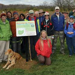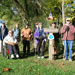
Our Buckeye Trail Towns provide destinations around which you can plan your outdoor recreation. Head here for a weekend or more and set up your base camp at a local campground, or enjoy creature comforts at one of the local motels or bed and breakfasts. There are hometown restaurants, shops, and other in-town amenities to complement your outdoor forays on the Buckeye Trail and other hiking trails, along creeks and rivers in your kayak, or out on mountain bike trails on your bike.
Get to know the backroads and byways and genuine friendliness of small town Ohio as you base your next outdoor expedition from a Buckeye Trail Town Community!
Spencerville – Trail Town Dedication coming in 2024
The Buckeye Trail Association welcomes Spencerville as the 21st Trail Town. Spencerville is a small rural, agricultural community of around 2200 residents, in northwest Ohio, west of Lima. The formation of the village is directly due to Spencerville being located on the Miami and Erie Canal. The canal was opened for traffic in 1844. The village was laid out for Tyler, McConnell, and Conover of Dayton when they purchased a tract of 350 acres and built a mill at the upper lock.
The name was bestowed in honor of Colonel Spencer, a member of the State Board of Public Works in 1848 and an ardent supporter of canal-building enterprises. This area of Ohio in the 1800s still had wooded forests that supplied lumber mills and stave factories in Spencerville. The narrow-gauge railroad entered the village in 1878 and 4 years later the Chicago and Atlantic Railroad connected the village in direct communication with the east and west.
Spencerville continues the historic nature of the Miami and Erie towpath for the trail user. The village falls ten miles between the Trail Towns of St Marys and Delphos, making it the perfect day hike length for a section hiker. With ample parking, Spencerville can be a perfect staging town to recreate out of, whether it is hiking, biking, cross-country skiing, bird watching, or family walks.
Spencerville is the beginning location for the annual ‘Memorial to Memorial on Memorial’ hike. This hike begins at Spencerville Area Veterans Memorial Park, following the Buckeye Trail⁄Miami & Erie Towpath to the Delphos Veterans Memorial in Delphos on Memorial Day.
Fort Loramie – Trail Town Dedication September 23, 2023
The Buckeye Trail Association welcomes Fort Loramie as the 20th Trail Town on September 23, 2023. Fort Loramie, in the St Marys Section, is a village in Shelby County, along Loramie Creek, a tributary of the Great Miami River in southwestern Ohio, 42 miles north-northwest of Dayton.
The village of Fort Loramie is an original canal town along the Miami & Erie Canal. It was first established as a trading post by a French-Canadian fur trader Pierre-Louis de Lorimier (Peter Loramie). The indigenous Shawnee people used the post for attacks against the European settlers during the Revolutionary War. The post was burnt to the ground and abandoned in 1782, remaining vacant until 1795. After the victory of the Battle of Fallen Timbers, General “Mad” Anthony Wayne ordered a fort built at the site. The fort stood on the portage between St Mary’s River and Loramie Creek a half mile north of the present town. It was used as one of the demarcation points in the Treaty of Greenville in 1795.
When work started building the Miami-Erie Canal in 1836, German immigrants were the main labor pool building the canal. The immigrants then purchased land and became permanent settlers. The canal opened in 1841, bringing finished goods to the area, and taking farm and wood products back to the cities. The village was originally called Berlin. The town's name was officially changed to Fort Loramie in 1911. The canal system had diminished by this time, as a result of the railroad networks expanding in all directions. The canal, which ran through the center of town was cleaned up and turned into a community park.
An important feature remaining from the canal days is Lake Loramie, the feeder lake manually constructed to keep the canal filled with water. It is now a state park and a haven for fishing, boating, camping, and vacationers.
In recent years, a self-funded research group conducting archaeological digs has rediscovered the site of both Pierre-Louis de Lorimier’s trading post in 2013 and the north wall of the original stockade in 2020.
Delphos – Trail Town Dedication September 17, 2022
Delphos Trail Town Dedication will be Saturday, September 17, 2022 in Delphos, Ohio. The ceremony will be at 11:30 am at the Delphos Canal Museum at 241 North Main Street. A short reception will follow at the museum. This dedication is on Day 3 of Canal Days, Delphos' end of summer, premier festival. 2022 is the 60th Canal Days Festival in Delphos.
Delphos is located on the northwest portion on the Buckeye Trail in Allen and Van Wert Counties, and was formed in 1851 from 4 small towns. It was a major port on the Miami and Erie Canal, an early hub for narrow gauge railroads and on the original route of the Lincoln Highway. By 1879, there were over a hundred factories churning out goods for the world, and even today the city enjoys an international reputation as a manufacturing center.
The City of Delphos is very proud of their history with two museums located on Main Street to reflect this. The Delphos Canal Commission Museums chronicles the history of Delphos, Northwest Ohio and the Miami and Erie Canal. The museum displays more than a quarter million stamps, antique postal vehicles, mailboxes, historic postal media and much more with a newly opened second floor.
Delphos welcomed the Buckeye Trail in 1975 by offering its city parks for camping to hikers and looks forward to welcoming more outside adventurers into the future.
Spring Valley – Our Newest Trail Town Was Dedicated August 22, 2022
Spring Valley is a village located in the southwestern portion of the state, in Greene County, in the Caesar Creek section. It was built on a slope rising from the banks of the Little Miami River, benefiting from many natural springs in the area. It was founded in 1844 and was at the crossroad of two early transportation routes, the Cincinnati-Xenia Pike and the Little Miami Railroad, which allowed it to become established as an agricultural marketing and processing center for the area.
The Buckeye Trail enters Spring Valley from the east, following Old US 42 into the village, where it joins and runs concurrently with the Little Miami Scenic Trail north. Primitive camping is available at Constitution Park with access to the Little Miami River for kayak or canoe launching.
Wakeman – Trail Town Dedication June 25, 2022
Buckeye Trail Association welcomed Wakeman as the 17th Buckeye Trail Town on June 25th with Wakeman village officials at the Wakeman Community Park. Afterwards, the celebration was held at the Wakeman Elevator. Wakeman volunteers, village officials, and Buckeye Trail Association members worked together to collaborate to make Wakeman a Buckeye Trail Town, located in the Norwalk Section of the Buckeye Trail.
Founded in 1824, Wakeman is an old railroad town about half way from Cleveland to Toledo and located just a few miles south of Lake Erie on the Vermilion River. Back when the rail was still running, it would stop at Wakeman to fire up the coal engine and refill the coal car, while taking passengers on its way to and from the two major cities. A visit to Wakeman Village wouldn’t be complete unless you walked the downtown area. The downtown hosts many businesses: an upscale florist and gift shop, smoothie shop, homemade ice cream, pizza parlor, coffee shop, beauty salon, a pub, bank, and two automotive shops.
Visit Wakeman's own Trail Town web page for more information.
St. Marys – Trail Town Dedication October 17th, 2021
On Sunday, St. Marys, Ohio became the next Buckeye Trail Town. The ceremony will took place at 11:30 A.M. at the Gazebo in Memorial Park. The Miami & Erie Canal Chapter will be manned a booth at the Walk with Nature Festival from 12:00 until 5:00 P.M.
Before the white men ever came to the area, Indians found the St. Marys River to be an important travel route. By portages of only six miles at high water and 26 at low water they could travel all the way from Lake Erie to the Gulf of Mexico. Before the construction of Grand Lake St. Marys, which drained about half of the river's watershed area, the river could handle the largest flat-bottom boats.
To read more about St. Marys and its rich history, visit: St. Marys Ohio
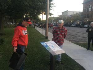
Chardon – Trail Town Dedication October 5th, 2019
Chardon was founded in 1812 and later incorporated into the Village of Chardon in 1851. In the 2000 census, Chardon's population reached 5,000, changing the community from a village to a city. Even though the town achieved City status, the close-knit community still maintains its charming, rural character while still offering residents desired, modern day amenities.
Located approximately 35 miles east of downtown Cleveland, Chardon is among the early communities in the Western Reserve. Today, Chardon remains a town rich in history and culture with its Square as the heart of the City. Many activities and events are held there throughout the year, including summer concert series, car shows, farmers' market, and most notably the annual Geauga County Maple Festival which celebrates the county's maple syrup production industry and kicks off the spring season.
Those utilizing the Buckeye Trail will find there is something new and exciting going on all the time in Chardon. From visiting our fantastic antique and resale shops and dining in the City's Main Street district to exploring the park system or arts and culture offerings, Chardon keeps residents and visitors engaged all year round!
For a listing of available retailers along the trail and upcoming community events, visit http://www.ChardonSquareAssociation.org
Read more about Chardon and all is has to offer at
http://www.chardon.cc
Napoleon, Trail Town Dedication May 16, 2019

Napoleon is excited to welcome you as you explore the Buckeye Trail in Northwest Ohio! Napoleon is a community of just over 9000 people located on the Maumee River just a half hour southwest of Toledo. As you trek through our area, it’s easy to transport yourself back hundreds of years and revisit the footsteps of Native Americans who called this land home. A large portion of the Buckeye Trail through Napoleon is part of the original Tow Path for the Miami Erie Canal – the water highway that led to the growth of our region.
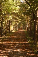
If you are looking to make a day (or longer) stay in Napoleon – make sure you take a moment to explore the community. There are a multitude of events going on in this vibrant community – find out what’s happening (and where) on the web at henrycountychamber.org or contact the Henry County Visitors Bureau at (419) 592-1786. They’d be more than happy to help you craft your stop and point out the fun you’d like to dive into.
Napoleon will open its doors and its arms to you whenever you plan on stopping through! We’re proud to embrace the history of the area and welcome you to become part of our present and future!

Deersville - Trail Town Dedication April 27, 2019
The small village of Deersville is nestled in the eastern Ohio hills of Harrison Count with Tappan and Clendening Lakes nearby. Historic Deersville, which was established in 1815, offers a step back in time to its visitors. The Deersville General Store is the heart of the community. It has been around since 1898 and is famous for its homemade ice cream. The store also offers a little bit of everything from snacks, deli, pizza and other hot foods, beer, ice, grocery items, fishing and camping supplies and fuel.
Nearby Tappan Lake Park part of the MWCD, has over 500 campsites and vacation cabins. The park offers a beach, trails and activities to it's campers as well as to those who just want to spend the day. It's a great place to fish and there is a 399hp limit for all types of boating adventures.
The Deersville Theatre is a fantastic attraction. The Deersville Players give performances in the Spring and Fall. The village has a number of beautiful historic homes available as vacation rentals.
Also of note, Deersville is also home to the Buckeye Trail Association's Official Ice Cream Buckeye Krunch which is a Vanilla based Ice Cream with Peanut Butter Cups, Crispy Rice, and Blue Sprinkles. It is sold exclusively at Deersville General Store. A portion of the sales also benefit the Buckeye Trail Association.
Shawnee – Trail Town Dedication October 14th, 2018
Nestled in the foothills of Appalachia in Southern Perry County is the historic coal mining village, now Trail Town, known as Shawnee. Settlers first arrived in the area around 1814, however the town government wasn’t established until 1874. This friendly little town is home to scenic views along Main Street, featuring overhanging second-story porches and unique architecture, which lends to the imagination what the quiet streets would have looked like at the turn of the century with over 4,000 residents! Today, Shawnee is home to approximately 650 people, who are descendants of the Welsh, German, Scottish, Irish, and Italian immigrants who came here in the early 1900s to work in the mines, and create homes and lives for their families.
In 1952, after all mining and brick factories were shut down, local townspeople convened and decided to construct a new recreational area on the outskirts of town, with the hopes of drawing people back to the once booming city, this man-made structure is known as Tecumseh Lake. Today, the lake is still a popular destination for hikers, fishermen, and kayakers and shows that resourcefulness is not a quality that has been lost through the generations! Shawnee is home to many flourishing organizations including Destination Shawnee, Ohio Hill Country Heritage Area, Little Cities of Black Diamonds Council, and hosts the state headquarters for the Buckeye Trail Association.
Located in the heart of Wayne National Forest, Shawnee is surrounded by miles and miles of public land. Ohio’s only national forest boasts over 100,000 acres that are used for hiking trails, fishing sites, camping areas, horseback riding trails, birding areas, and ATV riding areas. As if that wasn’t enough, Shawnee is also only a quick trip away from Burr Oak State Park and Hocking Hills State Park which claims over 2,500 acres of gorgeous waterfalls, trails, caves, and more. This close proximity makes Shawnee ideal for a trip to nature, with something for everyone!
Shawnee is proud to have become a Trail Town and hopes to work closely with the Buckeye Trail Association in order to promote outdoor experiences. Thank you, we hope to see you soon!
Mentor - Trail Town Dedication August 25, 2018
The City of Mentor is proud of our status as a Buckeye Trail Town. We are a part of the Bedford Section which leads to the Northeast Terminus of the Buckeye Trail at Headlands Beach State Park– Ohio’s longest natural beach!
You’ll make your way through the Mentor Marsh – an important stop for migratory birds in the spring and fall. Enjoy the natural splendor and photo opportunities of this unique ecosystem at the Mentor Lagoons Nature Preserve & Marina and the Mentor Marsh State Nature Preserve.
There is a lot to see and do in Mentor and neighboring communities. History buffs will enjoy the stoic tranquility of the James A. Garfield National Historic Site - home to our Nation’s 20th president and what is widely regarded as the first Presidential Library. The nearby Holden Arboretum is one of the largest arboreta and botanical gardens in the United States, with more than 3,600 acres, including 600 acres devoted to collections and gardens. And you’ll want to make sure you time your visit to take advantage of one of the great events hosted by the City each year – including their free Mentor Rocks summer concert series.
Last but not least, when you’re ready to take a break or need to replenish, Mentor is home to over 325 retailers, 170 eateries, as well as 9 hotels. Download a free Mentor Visitor Guide at www.visitmentor.com to plan your trip.
Mantua - Trail Town Dedication July 14, 2018
Andrew Bashaw, Executive Director of the Buckeye Trail Association welcomed the village as the 10th Buckeye Trail Town. The festivities took place at the bridge at the Headwaters Trailhead. Bashaw commended the village for becoming a Trail Town, welcoming Buckeye Trail travelers with hospitality during their visits to the area. He noted the opportunity this partnership provides, the prospect “for us to do more and more over time.” Mantua Village Mayor Linda Clark concurred, sharing; “This is an excellent opportunity for your community.”
Defiance - Trail Town Dedication June 23, 2018
Defiance is the heart of the historic Maumee River Valley and is where the Maumee and Auglaize Rivers meet. From its earliest days, Defiance has been a hub for the shipping and receiving of goods. Whether it was early supplies passing through Fort Winchester or goods being transferred on the Miami-Wabash and Erie canals that ran through the community, transportation has played a major role in our development. In later years the addition of several railways that traveled through Defiance helped to facilitate the industrial growth that continues to support the city today.
Explore the history of the area by visiting the site of the old French Apple Tree in Pontiac Park where tribute is paid to Johnny Appleseed’s influence. In Canal Park, catch a glimpse of days gone by at the restored Miami and Eric Canal Lock. Spend a day in the surrounding vicinity experiencing the small town feel of the country farms and abundant farmland, continue your experience at one of the inviting shopping centers or beautiful parks. Don’t leave town without spending time in the revitalized Main Street District of Downtown.
Yellow Springs
The Village of Yellow Springs became a Trail Town as part of the BTA's 2017 TrailFest Celebration. The trail goes right through downtown.
You can purchase Buckeye Trail maps and merchandise at the official Buckeye Trail Shop which is Yellow Springer Tees and Promotions, located at 225 Xenia Ave.
The community of Yellow Springs is diverse with an authentic downtown with an eclectic assortment of shops, galleries and restaurants; recreational opportunities at Glen Helen Nature Preserve, John Bryan State Park, and the Little Miami Scenic Trail; and cultural activities within the village itself and at Antioch College.
Loveland
The City of Loveland was formally designated as a Buckeye Trail Town on April 22, 2017. The City of Loveland is proud of the Trail Town designation and welcomes all the many hikers and cyclists to our wonderful downtown. The Little Miami Scenic Bike Trail runs through the heart of Downtown Loveland with a wide variety of businesses and direct access to Nisbet Park. Nisbet Park includes restrooms and picnic shelters. Approximately 1000 feet north of Nisbet Park is a primitive campsite location. The campsite is free of charge we simply request notification of your stay in advance by emailing your name, dates and contact information to
View Larger Map
ZOAR
Zoar, Ohio is our newest Trail Town and was dedicated on May 13, 2016 at TrailFest.Zoar Village was founded in 1817 in Northern Tuscarawas County, Ohio near the Tuscarawas River by a group of 200 German Separatists seeking escape from religious persecution in their homeland. These Separatists thrived as a unique Society for more than 80 years, making Zoar Village one of the most successful communal settlements in American history. Today, Zoar Village is made up of approximately 75 families living in homes built from 1817 to the present.
The Buckeye Trail comes to Zoar past Ft. Laurens and using the Zoar Valley trail, towpath trails, and a foot bridge leading into Zoar.
The North Country Trail, which runs concurrently with the Buckeye Trail through most of Ohio, does split off from the Buckeye Trail and heads east toward Pennsylvania. Cared should be taken not to follow the North Country Trail, as it is also blazed in a similar blue color.
Click on the following link for a listing of local lodging, dining, shopping, and attractions: Historic Zoar Village
TROY
The City of Troy is a wonderful place for activity, recreation, and of course hiking. We are your hometown city with all of the things you remember. The old fashioned downtown, the corner bicycle shop, and a place to get ice cream, the kind of city you would feel at home in as you travel the Buckeye Trail. Placed along the Buckeye Trial are the Miami Shores Golf Course, Hobart Arena, Memorial Stadium, parks, and our re-developing Treasure Island Marina Area. The Miami County Park District is moving toward developing a primitive camping area just north of the city.
Significant investments are upcoming in Troy’s riverfront park area, with items such as a new outdoor amphitheater, a river and trails activities rental center. Also the future holds a dramatic revitalization of Hobart Arena.
Troy is located along I-75 just ten miles north of the interchange of I-75 and I-70. . Nearly all of the Buckeye Trail in the Troy area travels alongside the beautiful Great Miami River, inviting you to come and visit.
Learn more and plan your visit to Troy here:: Troy Ohio
View Larger Map
Piqua
Piqua, Ohio is located along Ohio’s Great Corridor, on the banks of the Great Miami River, and is home to many historical points of interest, a charming downtown, an impressive parks system, and many other attractions and amenities.
The Buckeye Trail enters Piqua from the south sharing an alignment with the Miami Valley Trail system and paralleling the scenic Great Miami River Water Trail. After crossing over the river, the Buckeye Trail joins the former Miami & Erie Canal alignment and continues to Lock Nine Park in downtown Piqua. Upon arriving in downtown Piqua, hikers will find a chocolate and coffee shop, an ice cream parlor, and restaurant options offering good eats and refreshing beverages. Downtown is also home to the public library, post office, laundry services, and banking establishments. Fort Piqua Plaza and the YWCA and YMCA can also be found downtown. Just to the west of downtown is the Caldwell Historic District, home to many beautiful residential structures, places of worship, and a bed and breakfast.
As the Buckeye Trail heads west out of downtown it follows the Piqua Activity Trail for Health to French Park, and then turns north and follows and alignment alongside the calm waters of Franz Pond, Echo Lake, and Swift Run Lake. On this segment of the trail, hikers will pass by a prominent mansion serving as a bed and breakfast, picnic shelter facilities located in Fountain Park, and the tranquil beauty of Forest Hill Cemetery. As hikers continue north, at the edge of the community they will discover Johnston Farm & Indian Agency, a state historical site including an education center, and a canal boat ride on a preserved section of the Miami & Erie Canal.
Click on the following links for a listing of local lodging, dining, shopping, or attractions.
For more information about Piqua please visit:
http://www.piquaoh.org/
http://piquaareachamber.com/
http://www.mainstreetpiqua.com/
http://www.homegrowngreat.com/
View Larger Map
Xenia
On September 5, 2014, Xenia became an official Buckeye and North CountyTrail Town. On September 10th, the Downtown Xenia Historic District was officially listed on the U.S. Park Service’s National Register of Historic Places. With such milestones, Xenia is especially proud to share our new Trail Town status with our many trail loving friends.
The City of Xenia was one of the first Ohio cities to fully embrace the “rails to trails” system in 1991, and is a hub to the largest bikeway network in the country. In addition to hiking trails, Xenia is “Ground zero” for four different rail conversions or trails in the region—with the Little Miami Scenic Trail, the Ohio-Erie Trail, the Creekside Trail and the new Jamestown Connector Trail all radiating from downtown. Nonprofit group Friends of Xenia Station continues making the Xenia Station a beautiful, clean respite for trail users. Xenia Station houses both the Greene County Parks & Trails Rangers and Sentinels and a mini-museum from the Greene County Historical Society. Across the street at 150 Miami Avenue, Buckeye Trail hikers can wander the Greene County Master Gardener’s Phenology Garden—an attractive real-life study in the annual cycles of plants and how they respond to seasonal changes in their environment. Before you hike, you may want to download a Xenia Historical and Architectectural Tour by foot or bicycle and enjoy learning about the structures and history of this area. To the north and east, Xenia boasts trail connections to many nearby universities -- including several of the oldest historically black colleges and universities and one new land grant college. Central State University, Payne Theological Seminary, and Wilberforce University are all three along our Ohio-Erie Trail and a short 4 mile hike from downtown. Add close proximity to Antioch College, Antioch University Midwest, Cedarville University, Clark State Community College and Wright State University and there are a multitude of activities and interests within hiking and biking distance.
With the help of their robust trail system, Xenia is experiencing a renaissance as an authentic downtown brought on by building renovations and by the continued efforts of Downtown Xenia Now, a public-private partnership recently formed to advance the economic and social vitality of Xenia by strengthening its core.
For more information about Xenia please visit:
www.ci.xenia.oh.us
www.xenianow.org
www.xacc.org
View Larger Map
Dayton
Dayton is located along the banks of the Great Miami River on Ohio’s Great Corridor and is known as the Outdoor Adventure Capital of the Midwest. Beyond the plethora of hiking opportunities; Dayton is a Bicycle Friendly Community situated at the center of the largest bikeway network in the country. The gem city also hosts some of the largest outdoor recreation events in the Midwest while being situated amongst 3 state designated Water Trails.
The Buckeye and North Country Trail wind along Dayton’s scenic rivers as the trail passes through several of Five Rivers MetroParks along land managed by the Miami Conservancy District. The trail through the Greater Dayton Region is one of the longest continuously off road sections along the entire BT and NCT at nearly 40 miles. Hikers are treated to the rich history of Dayton as the trail passes near sites of the Dayton Aviation Heritage National Historical Park, the National Museum of the United States Air Force, and Deeds Point MetroPark where hikers walk up on a dramatic view of the Dayton skyline and more.
Dayton offers hikers a range of services from outfitters, camping, restaurants, and even outdoor guiding companies. The outdoor scene is strong and growing in the region with over 45 outdoor oriented businesses and 50 outdoor clubs creating a vibrant outdoor culture. Come hike, bike, paddle, fish, and more on the incredible natural assets of the Miami Valley…Get Out & Live!
Read more about Dayton and the BT here.
For a complete list of services, retailers, camping, and more go to outdoordayton.com.
Milford
Milford is the first Buckeye Trail Town and is an ideal setting for day hikers and backpackers. The city is located at the intersection of eight of America’s long distance trails See below for list of these trails, which together total over 22,000 miles of hiking and biking opportunities. The Buckeye Trail winds through Milford’s streets offering a pleasant way to explore the many facets of the town before you continue your trail adventure. Two sections of the Buckeye Trail connect in Milford (the Loveland and Williamsburg sections), making Milford a perfect spot to camp, resupply, and recharge before moving on with your Buckeye Trail, North Country Trail, or American Discovery Trail adventures.
The eight long distance trails - Buckeye Trail, North Country Trail, American Discovery Trail, Sea to Sea Long Distance Hiking Route, Underground Railroad Cycling Route, Ohio to Erie Cycling Route, the Little Miami Scenic River, and the Little Miami Scenic Trail.
Milford offers a variety of features including a charming main street, hiker friendly shops and restaurants, attractive architecture, several camping locations for through hikers, an interesting history and the beautiful 130 acre Valley View Nature Preserve". The trail follows sidewalks through town, permitting access to the above mentioned features, including a very trail friendly outfitter store (Roads, Rivers, and Trails. The trail passes some lovely historical homes as it wends its way to the woods and trails of the Valley View Foundation. There is plenty for the hiker to enjoy.
There are three camping locations within the Milford area: Valley View, Riverside II Park, and Jim Terrell Park (which has an Adirondack type shelter). For the latter two locations a permit is required and there is a small fee. See the Milford Parks page for the permit info.
Read more about Milford and the BT here.
Learn more by visiting http://www.milfordohio.org.
Create a Trail Town in your neck of the woods
Chances are you already have a relationship with the Chamber of Commerce, local businesses and other community partners. This program simply helps identify ways the town and the Trail can work together, plan together and capitalize on the benefits the BT can bring to the area. Contact our Trail Town Coordinator at
for more information.

