
Sinking Spring Section
- Overview
- Akron
- Bedford
- Belle Valley
- Bowerston
- Burton
- Caesar Creek
- Defiance
- Delphos
- Loveland
- Massillon
- Medina
- Mogadore
- New Straitsville
- Norwalk
- Old Man's Cave
- Pemberville
- Road Fork
- St. Marys
- Scioto Trail
- Shawnee
- Sinking Spring
- Stockport
- Troy
- West Union
- Whipple
- Williamsburg

Trail Description
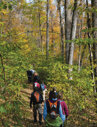
Fort Hill hike.
Darryl Smith
Supervisor: Angela Rhodes
•
53.5 Total Miles / 21.6 Off Road Miles (40.4%)
Map Publication Date: September 2013
The Sinking Spring section offers some beautiful scenery and hiking as it's northern half passes through Pike State Forest. Almost 24 miles of the trail passes through the forest or adjoining Pike State Park, utilizing forest roads, abandon dirt roads and plain old trail. Plenty of facilities are available in the park. After crossing SR 41, the trail enters the Fort Hill historical area, site of a Hopewell Indian ceremonial mound built 2000 years ago. A side trail leads to the mound atop the hill. Nearby is Butler Springs Christian Center, site of several BTA Annual Meetings, including 1999. The Buckeye Trail continues through Fort Hill on trails before finally going on roads. After passing through Sinking Spring, the trail goes by another Indian mound at Serpent Mound. South of SR 32 are several miles of trail, over Tolle Hill, through Davis Memorial and near Mineral Springs Lake.


Trail Alerts
- (10/22/24) Andrew Bashaw, BTA Executive Director, has issued this alert for the Sinking Spring Section between Points 6 and 7.
Please exercise caution when hiking this area due to aggressive dogs on Shoemaker Road before reaching Western Local School District.
Map Updates
- (11/1/24) This map update replaces a map update from 11-1-2023 that replaced a trail alert from 1-2019 that addressed a trail slippage close to the end of Point 3 near Greenbriar Rd. The BT now follows the original trail, has been rerouted around and to the west of the slippage, and rejoins the trail. The update restores the description for Point 3 in the 2013 version of the Sinking Spring map and in the Spring 2024 versions of the Avenza and FarOut Apps
The description for Point 3 is as follows:
Point 3 Foot Path at Greenbrier Rd (T237)
LB Campground f is 1/2 mi W on Greenbrier Rd 740-493-2470. Descend into valley of Left Fork of Morgan Fork on foot/bridle trail that is named the “Jim Sprague Trail” in honor of Jim’s dedicated, service as former Buckeye Trail Crew leader and organizer. In 2.1 mi, join Greenbriar Rd that descends NW. In 150 ft, head E on Auerville Rd (C20).
Point 4 Auerville Rd at Fire Tower Rd (T229)
Resume use of your Sinking Spring Map Edition of September 2013. - (1/15/19)This trail change applies to the Sinking Spring Map Edition of September 2013. Note that a very small change in the trail has moved Point 1 to Pike Lake Rd just E of the Pike Lake State Park store. This change decreased the distance to Point 2 by 0.1 mi.
- (4/26/18)This Trail Change applies to the Sinking Spring Map Edition of September 2013, the most current map. The change occurs between Points 16 and 17. The section length has been increased by a little over 0.1 mi by this change.
CW CCW Pt 27.6
S26.5
N16 SR 41 at SR 124 in Village of Sinking Spring
Facilities: G, PO 45172, R, T, W. Restored octagonal building in the Village Park was a schoolhouse.
Head E on SR 124. After 0.28 mi, exit the Village of Sinking Spring and enter Pike Cty from Highland Cty. After 0.11 mi where SR 124 turns NE, turn SE onto Dogwood Lane (T202). {After 0.2 mi at an easterly bend in Dogwood Lane, pass a private driveway that exits SW. After 200', exit Dogwood Lane SW into woods on ATV trail. Follow this ATV trail mostly S along an old fence line for 0.45 mi to a bend in an old skid road. Join skid road, descend generally SW into Strait Creek Bluffs Nature Preserve, a property of The Nature Conservancy. Soon, ford a small stream (200'.)
Continue on skid road SE to S.} After 0.1 mi, go beneath power line, turn hard E after 0.17 mi and soon enter woods. After a long meander (0.4 mi), emerge from woods onto a high prairie.Head generally S across the prairie. After 0.28 mi, enter a major ravine heading SE and begin a slow meandering descent through woods and wonderful dolomite cliffs towards Strait Creek below. After 0.4 mi, reach and ford Strait Creek. Ascend the far side of this ravine heading NW. Meander with moderate undulations generally S through woods above Strait Creek.
As the ridge that the trail has been following ends, turn away from Strait Creek. Descend to cross Smokey Corner Rd (T201) and a minor stream. Then, climb slowly W. Soon, trail resumes its meandering, undulating ways. After 0.3 mi, reenter Highland Cty from Pike Cty. After 0.35 mi, cross ditch and turn SW onto SR 41.31.5
W22.6
NE17 SR 41 at Straight Creek Rd (T239) To make an approximate correction of your September 2013 Map, add 0.1 mi to all CW distances following Point 17 and add 0.1 mi to all CCW distances preceding Point 16. - (6/17/15) This update addresses two issues regarding the September 2013 Edition:
1. A road on the map is named incorrectly. About midway between Pt 19 and 20 on the Sinking Spring Section Map, a road heading west is labeled "Louisville Rd C15". The correct label should read "May Hill Rd C15C". While the text did use the correct name for the road, the county designation is a shortened version. It should read "C15C".
2. The owners of the campsite adjacent to Serpent Mound State Memorial request advance notification before its use. An updated version of CAMPING FACILITIES is shown below. Please substitute this copy for that shown in the present edition.
CAMPING FACILITIES
The location of all campsites, that are known to BTA and are within reasonable walking distance of the trail, are shown on the Section Maps.
The Buckeye Trail Association oversees one campsite within Sinking Spring Section. It is on GoodSeed Farms located within 0.5 mi. of Pt 22. Notify about any problems. Camping, subject to rules imposed by the Owner/Manager, is also available at Pt 1 within Pike Lake State Park (fee) (740-493-2212), near Pt 3 0.5 mi W on Greenbriar Rd at LB Campground (fee and seasonal) (740-493-2470), near Pt 10 within Cave Lake Park (937-588-3252), near Pt 13 at Butler Springs Christian Camp (937-588-2305) and on private property that is located between Pt 18 and Serpent Mound State Memorial and owned by the McKenzies (937-587-3953). The McKenzies have requested that hikers call at least 24 hours before arrival at the site.
Trail Towns
Peebles – May 27, 2025
The 22nd Trail Town along the Buckeye Trail is Peebles, a village in the Sinking Spring Section of the Buckeye Trail. Peebles is nestled in the Appalachian Foothills of Ohio. This is the first Trail Town for the Appalachian Foothills Chapter of the BTA.
Peebles is home to the National Landmark site of The Great Serpent Mound. The Great Serpent Mound is a 1,348-feet-long (411 m), three-feet-high prehistoric effigy mound. The mound is the largest serpent effigy known in the world. The Serpent Mound is located on the edge of a great crater, known as the Serpent Mound Crater or Disturbance. The crater is located on a plateau in the Brush Creek Valley and is classified as a complex crater because it has a central uplift, as well as, a transition zone, and a ring-shaped trough at the outer part of the crater. The crater is about 5 miles in diameter.
In 2003 geologists from the Ohio State University and the University of Glasgow in Scotland corroborated that the Mound is located on the site of an ancient meteorite impact structure.
The village was platted in 1881 by Isaiah Custer at the junction of Zane’s Trace and the Cincinnati & Eastern Railway, named after John G Peebles, who was instrumental in bringing the railroad to the settlement. The village was incorporated in 1886.
A proclamation ceremony to celebrate Peebles as the 22nd Trail Town will be held in the near future.
Section Blogs
- (11/6/23) Sinking Spring Section Blog - Provided by Victoria Livingston, BTA hiker. Make plans to hike Fort Hill to experience massive rock walls, caves, lush forests, history, and a few surprises thrown in. Here are Seven Reasons You Must Visit Fort Hill.
- (11/6/23) Sinking Spring Section Blog - Provided by Victoria Livingston, BTA hiker. What is a tick bomb? Beware of tick larvae lurking in high grasses or you may find yourself covered in tiny but extremely itchy spots. Take these precautions to avoid this fiasco.