
Medina Section
- Overview
- Akron
- Bedford
- Belle Valley
- Bowerston
- Burton
- Caesar Creek
- Defiance
- Delphos
- Loveland
- Massillon
- Medina
- Mogadore
- New Straitsville
- Norwalk
- Old Man's Cave
- Pemberville
- Road Fork
- St. Marys
- Scioto Trail
- Shawnee
- Sinking Spring
- Stockport
- Troy
- West Union
- Whipple
- Williamsburg

Trail Description
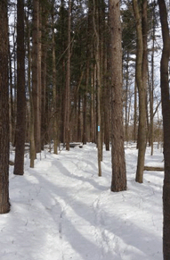
2015 Findley State Park Winter HIke
M D Edmonds
Supervisor: Patrick Hayes
•
55.8 Total Miles / 18.4 Off Road Miles (33.0%)
Map Publication Date: January 2017
This section begins south of Wellington on State Route 58 at Findley State Park and proceeds on footpath through the park. While much of the trail that follows lies on roads in a relatively flat, rural landscape, the trail crosses Spencer Lake on a causeway within Spencer Lake Wildlife Area, goes by Letha House Park (Medina County Park District), follows Lester Rail-Trail (Medina County Park District), enters the City of Medina and goes around Medina Public Square. Before exiting the city, the trail follows the Champion Creek Trail (City of Medina Park) and crosses Lake Medina Park (Medina County Park District).
The trail once again follows rural roads through rolling country-side. The trail leaves roads to cross through both Hinckley Reservation (Cleveland Metroparks), where it passes close by the famous Buzzard’s Roost and climbs through the rugged Whipp’s Ledges, and Richfield Heritage Preserve (formerly Camp Crowell Hilaka, now part of Richfield Joint Recreational District). The trail from the Medina Section ends in the Brecksville Reservation (Cleveland Metroparks) where it joins with Buckeye Trail from the Akron and Bedford Sections near Deer Lick Cave.


Trail Alerts
- (5/6/25) Medina Section trail alert Pts 12-13. The Medina County Courthouse on the east side of the square in the center of Medina City, is undergoing exterior construction which blocks the sidewalk and the BT that passes along the front of the courthouse. The detour described below is short: After reaching Court St on the NW corner of Medina Square, continue 1 block E along Liberty, to Broadway. Do not cross Broadway, but instead cross Liberty to the S. After 1 block, first cross Washington going S and immediately cross Broadway to the E. Rejoin the BT as it follows Broadway S to reach Champion Creek Trail at Pt 13.
Map Updates
- (9/1/24) Recently completed road construction on both sides of Medina Rd SR18 near the Lake Medina County Park included a new multi-purpose trail that now ensures a safe passage from Point 13 to Point 15. This new trail requires an update to the information in the 2017 Medina printed map and to the FarOut app. There is no difference in the length of the trail as the gist of the change is walking on the south side of Medina Rd (SR18) instead of the north side. The new information follows:
- (2/24/23) Polly Wheeler, Administrator Coordinator at Richfield Heritage Preserve, has confirmed that camping at the Preserve is once again available to Buckeye Trail through hikers.Follow this process to obtain the permit that is required to stay overnight at the Preserve, between Points 25 and 26. This location is listed on the map under "Camping Facilities." Use the link below to apply for the permit; complete this request form in advance of your stay.
Permit request form . - (7/11/2021) Medina Trail Change
This update announces a map change that affects your Medina map regardless of its date of publication although it relates specifically to the most recent version, January 2017. The segment affected lies between Pt 21 (State Rd (C44) Bridge over East Branch Rocky R) and Pt 22 (Top of the Ledges Picnic Area).
The reason for the change is a reroute conducted by your Buckeye Trail Crew with direction from Ralph Protano, Trails Development Manager for Cleveland Metroparks. The reroute moved the route of the trail from lowlands along the Rocky R which remained chronically wet and also changed the route through Whipp’s Ledges themselves. The new route has reduced the distance between Pt 21 and 22 by 0.2 mi. Details are presented below.
CW CCW Pt 42.0
N13.6
W21 State Rd (C44) Bridge over East Branch Rocky River
Continue N on APT along State Rd. After 300', shortly after where the Hinckley Lake Loop Trail exits W, turn E across State Rd and follow the drive toward Ledges Picnic Area. After 200', exit the drive onto the footpath at the base of steps; ascend E to a picnic area. After 0.11 mi, pass a BTA Interpretive Panel on lawn near the W end of the parking lot for Ledges Picnic Area. Join parking lot and head E. At the NE end of the parking lot near a picnic shelter, join a footpath that climbs NE on steps, crosses a service road that goes behind the picnic shelter, and continues NE. At the top of the steps (250’), turn N on footpath. The footpath will enter a field of boulders that have separated from the bedrock itself and are now sliding ever so slowly down slope. As the footpath climbs its way through these “sliders”, it turns gradually to the SE. And the boulders grow larger. After 0.1 mi, the footpath turns quite sharply N and ascends rather steeply into a slot between 2 massive rock walls, one of which is clearly the side of a slider while the other might be bedrock. Approaching the top of this slot, the footpath turns E and climbs to the rim of the ledges (300’). Here, the trail turns SE along the rim and you may look over more of these impressive cliffs from above. After 0.1 mi, turn N away from the ledges and ascend slowly.42.7
E12.9
S22 Top of the Ledges Picnic Area
Return to the text in your Medina map dated January 2017. The new route is about 0.2 mi shorter between Pt 21 and 22. Deduct 0.2 mi from the values quoted in CW direction for points greater than 22. Similarly, deduct 0.2 mi from the values quoted in the CCW direction for points less than 21. - (11/3/2020) Medina Trail Change
Medina County Park District (MCPD) has completed its improvements within their Lake Medina Park. The parking area at Pt 16 has been enlarged and a new restroom has been added. At both Pt 15 and 16, the parking areas have been freshly paved. In addition, some of the trails within Lake Medina Park have been paved also. Although we have revised the text a little, the distances printed in your current Medina Section Map remain unchanged.
CW CCW Pt 30.7
N25.6
S15 NW End of Parking Area for S End of Lake Medina
Lake Medina was the source of water for the citizens of Medina until 2002. Water was pumped daily from the Rocky R into the impoundment. It is now a unit within MCPD. Go N on an improved trail across a bridge over the West Branch of Rocky R (400'). Ascend the levee to the trail with views of Lake Medina. Head N around the W side of the lake. After 0.8 mi above a concrete building (the former pump house), the confluence of the N Fork and the W Fork may be seen just W of your present location. Continue on the trail as it descends to the paved path at the foot of the levee and heads NE32.0
NE23.8
SW16 NW End of Parking Area at N End of Lake Medina
Facility: P, Pr. Leave parking area NE on drive, etc. - (9/8/19) Medina Trail Change
At the request of the Friends of Findley State Park organization, the trail in Findley State Park has been moved onto the Wyandot Trail from the Hickory Grove Trail. This change does not make any significant change to the length of the trail. However, the front end of the text under Point 2, Medina Map Edition of March 2019, is totally changed.
New Text under Point 2:
Follow the Wyandot Trail E. After 0.45 mi at a 3-way intersection, join the Hickory Grove Trail heading NE. Shortly (0.16 mi) after the Wyandot Trail returns, exit the Hickory Grove Trail which turns N; go E. Soon, the Thorn Mountain Bike Trail joins the BT from the S and only after 0.3 to 0.4 mi does it exit N. After 0.45 mi at the edge of the park, join Hawley Rd; go S for 150 ft. - (8/4/19)Tom Barko has reported that a road name in BTA’s most recent Medina section official trail map, January 2017, is identified incorrectly. Although the road is named S Weymouth Rd in the text of the map, it is correctly named Old Weymouth Rd on the map itself.
The error occurs four times in the text following Pt 17 and once in the heading of Pt 18. Please mark your current maps to correct this error. - (6/6/18)The Medina Section Map dated January 2017 requires a very slight modification because Cleveland Metroparks has built an All Purpose Trail essentially where a Bridle Path was located in the past. The trail distance has not been changed significantly. The changes are being made to the text written as part of Points 28 and 29.
CW CCW Pt 53.2
E2.6
S28 Barr Rd at CMP All Purpose Trail (APT) along Valley Parkway
Near intersection, go E on paved APT that more or less parallels the S side of Valley Parkway within Brecksville Reservation, a unit of CMP, above I-77 (no access) and Highland Drive (0.7 mi).54.7
E1.1
W29 Bridle Path at Brecksville Rd (SR 21)
Continue E on paved APT past a small parking area (300'). Return to the text as written in your Medina Section map. - (12/28/16)This change does not affect the route of the trail. However, this is the method for obtaining the Camping Activity Use Agreement that is required to stay overnight at Richfield Heritage Preserve (RHP). (6/7/2021)NOTE: Camping is temporarily not available at RHP.
- (12/5/16) Exciting changes have taken place in the Medina Section. Hikers between Hinckley and Brecksville Reservations (Cleveland Metroparks) should notice a route change that begins at either the intersection of SR 303 and Oviatt Road if hiking in the clockwise direction or the intersection of Broadview Road and Alger Road if hiking in the counter clockwise direction. The benefits are twofold: a new camping opportunity and at least a mile of new trail off road. These benefits come with no significant change in overall distance.
Before I attempt to describe the route change, you need to know which edition of the Medina Map you are using because the map points depend on the edition. Except for the Edition of January 2007, the identity of your edition can be found on the front cover just above the map of the state. On the Edition of 2007, the identity will be found on the back cover as the copyright date.
The intersection of SR 303 with Oviatt Road is located on existing trail 0.3 miles west of a map point, located at the intersection of Medina Line Road and SR 303. This point is either Point 32 in both the January 2007 edition and the September 2013 edition and Point 25 in both the January 2015 edition and the April 2016 edition. The intersection of Broadview Road and Alger Road is either Point 34 in both the January 2007 edition and the September 2013 edition and Point 26 in both the January 2015 edition and the April 2016 edition.
The minimal detail provided below will be supplemented at a later date. As usual, the detail is described only in the clockwise direction:
From the intersection of SR 303 with Oviatt Road, turn back almost east and leave Oviatt Road towards the gap between an empty sign frame and a sign that points to Rising Valley Park north on Oviatt Road. Continue between a creek and an abandoned white house through a latched gate (400’) that is unlocked between dawn and dusk daily. Continue to follow the blue blazes through Richfield Heritage Park (formerly Camp Crowell-Hilaka). In due course, the blue blazes will lead you past a number of interesting features including old residences, man-made lakes, rocky ravines, tall timber and the campsites to a drive that leads by parking and through a gate (open dawn to dusk) east to Broadview Road (SR 176). At Broadview Road, turn northwest past a large grocery store. After 0.3 miles, reach the intersection of Broadview Road and Alger Road.
This is the end of the reroute. Continue on your way with the map edition you are using.
- (3/28/16) This Trail Change is small but very important. The trail may not be blazed through the interior of Medina Public Square. However, you will find blazes going around the Square on its north and east sides. The change has created no significant change in trail length. The significant change is that, since the blazes may not go through the Gazebo, Point 13 was moved south a tad to the beginning of the Champion Creek Trail on South Broadway St.
The revised details below refer to the Medina Section Map, Edition of January 2015.
CW CCW Pt 53.2
E28.6
W12 W Liberty St at N State St (MM, R)
Go E on sidewalk on either side of street. After 0.8 mi N Court St, reach Medina Public Square. There are many good restaurants on W Liberty St here. The blazes continue 1 more block on Liberty St before turning S on Broadway St. Continue on S Broadway St past the Library on the E side of the street.27.7
E27.5
N13 S Broadway at Champion Creek Trail
Just across Champion Creek, leave the sidewalk and turn E onto the Champion Creek Trail. A trailhead w/P, Pr is located behind the house just S of the building. Crossing Champion Creek twice, continue E on paved trail. The trail turns S near a substation. After 0.26 mi, reach Springbrook Dr and turn E on Champion Creek Trail. At the Entrance to Nichols Park (0.2 mi), enter Crestwood Park and meander generally E on the Champion Creek Trail. Exit the Champion Creek Trail at Guilford Blvd. Turn NE uphill across tracks past Roscoe Ewing Park (P, Pr). After 0.3 mi, Guilford Rd ends. Go E on E Washington St.29.3
E25.9
W14 E Washington St at Woodland Drive and W Entrance to Medina Hospital
| CW | CCW | Pt | |
|---|---|---|---|
| 28.1 E |
27.7 N |
13 | S Broadway at Champion Creek Trail
Just across Champion Creek, leave the sidewalk and turn E onto the Champion Creek Trail. A trailhead w/P, Pr is located behind and just S of the house. Crossing Champion Creek twice, continue E on paved trail. The trail turns S near a substation. After 0.26 mi, reach Springbrook Dr and turn E on Champion Creek Trail. At the Entrance to Nichols Park (0.2 mi), enter Crestwood Park and meander generally E on the Champion Creek Trail. Exit the Champion Creek Trail at Guilford Blvd which you will cross using crosswalk. Turn NE uphill across tracks past Roscoe Ewing Park (P, Pr). After 0.3 mi, Guilford Rd ends. Follow the curving sidewalk to the right (E) and go E on E Washington St. The sidewalk transitions to the new multi-purpose trail. In another 0.3 mi reach the entrance to Medina Hospital. |
| 29.7 E |
26.1 W |
14 | E Washington St at Woodland Dr and W entrance to Medina Hospital
Continue E on E Washington St crossing second Medina Hospital entrance (0.1 mi). Soon E Washington St changes its name to Medina Rd (SR 18). Cross Foote Rd using crosswalk going E. Follow trail another 0.4 mi as it passes Waterford Dr (0.15 mi, exits R), entrances to a church, a business, and the drive to Summa Health. At the pedestrian crosswalk, turn left (N) to cross Medina Rd. Now on the N side of Medina Rd, turn right (E) to reach Lake Medina County Park. Enter the park and proceed through the parking area. (Note: From the pedestrian crosswalk and before crossing Medina Rd, there is a major grocery 0.34 mi further E on Medina Rd, on S side of street. The grocery complex contains a bank, a restaurant, and a hardware with a US Post Office.) |
| 30.7 N |
25.1 S |
15 | NW End of Parking Area for S End of Medina Lake |
Trail Towns
- There are no Trailtowns in this Section at the present time.
Section Blogs
- (5/21/23) Medina Section Blog - Provided by Victoria Livingston, BTA hiker. Join Victoria and her husband Dave as they join the Circuit hikers in the Medina Section. Follow their adventure here when they were left in the dust!.
- (2/7/25) Medina Section Blog - Provided by Victoria Livingston. The Richfield Heritage Preserve was a highlight of the Buckeye Trail Points 22-30. It provided us with history, mansions, scenic views, and oddities! Discover the fascinating life and achievements of the inventor Jim Kirby. Read Victoria's post for Medina's Historic and Entertaining Trek: Richfield Heritage Preserve and More! from when she and husband Dave visited the Preserve..