Maps & Guides
Go to the Maps & Guides page for both electronic and printed maps & guides.


Go to the Maps & Guides page for both electronic and printed maps & guides.
Go to the Overview Map and click on the individual sections for all trail alerts.
Old Man’s Cave, Hocking Hills, Ohio
The circular nature of the Buckeye Trail lends itself to the circuit hike, a variation of the ‘end-to-end’ hikes common of more linear trails. Many people have completed the entire trail (generally over several years) by slowly ‘completing the loop’. For more information click here.
The length and breadth of Ohio's State Trail creates a backbone for Ohio's growing trail system. Ohio's Buckeye Trail is hosted by other trails, and is an integral portion of local trails networks within public lands near you. Check out Buckeye Trail Connections.
The Leave No Trace principles might seem unimportant until you consider the combined effects of millions of outdoor visitors. One poorly located campsite or campfire may have little significance, but thousands of such instances seriously degrade the outdoor experience for all. Leaving no trace is everyone's responsibility. The Leave No Trace 7 Principles.
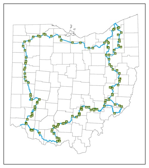
The locations of campsites, that are known to BTA and are within reasonable walking distance of the trail, are shown on the Section Maps. For special camping information, contact .
Various agencies and individuals operate campsites that are located along the trail. The owner/manager regulates each site independently. Dispersed camping is not permitted on private or state lands without express permission of the owner/manager. Hikers are expected to comply with the rules in all instances.
The Buckeye Trail Association does manage camping facilities in three sections:
The following map shows known camping locations along the trail. For details about each location we recommend you purchase the Section Maps for the areas that you are interested in hiking.
